Announcement: Fixed departure groups for


The special thing is that you can also do this trek together with the Har Ki Dun Trek, for which you must have Dehradun to Dehradun for 8 nights and 9 days. includes transport.
Highlights of Bali Pass Trek
Bali Pass is a high-altitude trekking route in the Garhwal region of the Indian state of Uttarakhand. Here are some highlights of Bali Pass Trek:
- Scenic beauty: The Bali Pass trek is known for its breathtaking scenery. You will come across snow-capped mountains, dense forests, gushing streams, and meadows filled with wildflowers.
- High altitude: The trek takes you through some of the highest altitudes in the region, with the Bali Pass summit at 4,953 meters above sea level.
- Challenging terrain: The trek is considered to be challenging due to its steep ascents and descents, rocky terrain, and unpredictable weather.
- Cultural immersion: The trek takes you through remote villages and allows you to interact with the locals, learn about their culture and way of life.
- Wildlife: The region is rich in wildlife, and you may spot animals such as musk deer, bharal (blue sheep), and Himalayan black bear.
What is special about Bali Pass Trek?
Trekking to this enthralling Bali pass can be a spiritual experience for a lifetime. Bali Pass Trek comes in the category of epic historic adventure treks where you can find the essence of mythology Chardham. Yamunotri Temple is the best part of this trek, with rich meadows, grasslands, mountain ridges, pine forests, glacial ranges, and jaw-dropping views of the Great Himalayas.
In addition, this is the only valley from where you can have a glimpse of elevated peaks like Bandarpoonch Peak -6300 Meters), Black peak -6387 Meters, Kalanag, Ruinsara Lake
Yamunotri Dham part of Bali Pass Trek
- Yamunotri Dham is situated in the Uttarkashi district of Uttarakhand.
- The Temple is situated in the western region of Garhwal.
- The Yamunotri is the source of the Yamuna River, about 3,293 m above sea level.
- Maharaja Pratap Shah of Tehri Garhwal constructed this temple. Yamunotri Dham is one of the Char Dham.
- Therefore People come visit to this place, and after visiting people go happily. People also come from abroad for this beautiful trek; coming to this place brings peace of mind. Sometimes people who come from overseas say that you are so lucky that you live in such a beautiful area.
- Char Dham is situated in the state of Uttarakhand. That’s why Uttarakhand is known as Devbhoomi, which means “The Land of the Lord”, 3500 Meters, Bali Pass 4950 Meters, and Swargarohini – I, II, and III – 6300 Meters Many others peaks!
During the trek, explore a sacred glacial lake “Ruinsara Tal” and further, pass through the route over Yamunotri to the holy pilgrimage site Yamunotri temple. Moreover, it is included in the list of virgin treks in Uttarakhand Himalayas. So, here are some attractions of this Trek – Ruinsara Lake, Govind Pashu National Park, rich meadows of Devshu Bugyal and Damini, and Odari Yamunotri Temple.
Adventurous Bali Pass Trek
Most importantly, the trek is a difficult one and not for beginners because the trail is exhilarating and includes crossing risky areas and steep ascents.
Therefore, the trek involves associated challenges but is great for adventure seekers and avid trekkers.
In addition to the adventure and beauty, the marvelous panorama views in the Himalayas Therefore, Bali Pass is a tremendous offbeat crossover trek in the Uttarakhand.
Why Choose Bali Pass Trek?
Before heading towards the itinerary, it is really essential to perceive the reason behind choosing the Bali Pass trek. See, firstly, the trekking distance is a total of by taxi 425 Km and on foot 64 km, which is to cover eight days.
Bali Pass is a high-altitude mountain trek Altitudes are 4950 Meters and 16207 ft The Starting trail is not that abrupt and sheer as compared to other treks. So this trek is not for beginners
Need proper gear & clothing for sub-zero temperatures?
Finally, You got to see so many heavenly bodies in one place like the panoramic view of the Himalayan ranges, meadows, one of the beautiful Ruinsara lakes, pine forests, and different varieties of flora and fauna surpassing through bona fide Garhwali heritage and culture.
In your spare time Interact with locals, and you will get to know about some of the ancient tales of Indian mythology. And, in summer, the Bali Pass valley turns different and amusing because of meadows, wildflowers, and woods blooming in different colors. Beautiful landscapes so carry proper photo gear and extra battery backup. The backpack should not exceed 10 to 12 kg only.
Bali Pass Trek Complete Guide
Our mission has always been to ensure that no trekker steps into the Himalayas without the right perspective. A trek is not just a checklist of summits; it is a serious commitment to the outdoors. Having the right information is what separates a reckless climb from a soulful journey.
This section serves as your definitive manual for the Bali Pass Trek. We have distilled years of mountain experience and real-time feedback into this guide to give you a clear, honest picture of the trail.
We provide this depth of information because we want you to be more than just a visitor—we want you to be a prepared, responsible trekker who respects the mountains as much as we do.
DAY 01 - Pickup Dehradun Railway Station Morning 07:00 Am |Drive to Sankri Base Camp Hotel The Grand Shiva, Via Mussoorie, Kamptifall, Damta, Purola, Mori Sankri, Drive Distance: 190 km | Duration: 08-09 hours | Overnight Stay Hotel at Sankri: Twin Sharing
DAY 2 – Drive from Sankri to Dharkot Gangad via Taluka 26 km 01 hours- Same Day Trek to Cheludgad Near Seema | Trek Distance: 3.5 km | Trek Time: 2/3 hours |Altitude: 8,158 ft | Overnight Stay Camp: Twin Sharing
DAY 3 – Trek from Cheludgad Camp to Devsu Bugyal | Trek Distance: 06 km | Trek Time: 4/5 hours | Altitude: 9,795 ft | Overnight Stay Camp: Twin Sharing
DAY 4 – Trek from Devsu Bugyal to Ruinsara Tal | Trek Distance: 10 km | Trek Time: 5/6 hours | Altitude: 11,720 ft | Overnight Stay Camp: Twin Sharing
DAY 5 – Trek from Ruinsara Tal to Odari Camp via Thaga Camp | Trek Distance: 03 km | Trek Time: 3 hours | Altitude: 13,120 ft | Overnight Stay Camp: Twin Sharing
DAY 6 – Trek from Odari Camp to Bali Col /Bali Base Camp | Trek Distance: 03 km | Trek Time: 3 hours | Altitude: 15,125 ft | Overnight Stay Camp: Twin Sharing
DAY 7 – Trek from Bali Col/Bali Base Camp to Lowar Damni Camp via Bali pass Summit attempt 16207 ft| Trek Distance: 14 km | Trek Time: 8/9 hours | Altitude: 10,111 ft | Overnight Stay Camp: Twin Sharing
DAY 8 – Trek from Lower Damani Camp to Jankichatti via Yamunotri temple | Trek Distance: 06 km | Trek Time: 3 hours | Same day to Drive Dehradun
Day 1
Day 2
Day 3
Day 4
Day 5
Day 6
Day 7
Day 8
Day 1: Pick up from Dehradun Railway Station 07:00 am Drive to Sankri (base camp) by taxi or tempo travellers
Total distance 190 – 8/9 Hours journey
Mode of journey – By taxi
Altitude Sankri base camp Altitude - 1920 m.
Night stay – Our Grand Shiva Hotel – on a twin share basis
Himalayan Hikers organizes transport for trekkers from Dehradun Railway Station in the morning which will leave for Sankri around 6:00 am to 7:00 am.
Dehradun is the capital of Uttarakhand and one of the most beautiful places in India. The main attraction of this place is Rajpur road go through it and get a glimpse of Dehradun’s beauty.
Reach Mussoorie after an hour which is also known as “Queen of Hills”. People visit it heavily during vacations with their family and friends. After half an hour, stop at Kempty Fall. Have breakfast there and witness people from different parts of the world. The break will be of a maximum of 1 hour. Ahead the peaks are visible and further you will come close to the holy Yamuna River. If you want, then take a short break of 20 minutes and enjoy being around it.
Further, you will cross the small markets of Nainbagh, Damta, and Naugaon. Reach Purola around 1:30 pm and take a break there for lunch. After having lunch proceed to Sankri via Jarmola. From there the back of Kedarkantha is visible. Go through the picturesque zig-zag road amid the pine forest of Jarmola.
Reach Mori and after 1 hour you will come across a check post. They will ask for Aadhar cards and some other details. Ahead lies Sankri, enjoy the drive and the wait is soon going to be over. Reach trekkers paradise and the main market of Sankri.
Go to Hotel Grand Shiva Swargarohini, freshen up, and enjoy evening snacks on the open terrace with great views. You will be provided some details after which you can go for an evening walk but be at the hotel for dinner.
Enjoy a delicious dinner and spend a comfortable night in the mountains.
Day 2: Trek from Sankri to Dharkot /Gangad Village via Taluka by taxi – 25 km same-day trek to Cheludgad camp!
Total distance 28 km – 4/5 Hours journey
Mode of journey – On foot – 03 km – By Local Taxi 25 km
Altitude Cheludgad camp – Altitude 8,158 ft
Night Stay – Our Campsite – on a twin share basis
After breakfast, ready for all trekkers we will drive towards Gangad Village via Taluka on the way beautiful forest with many species of trees, Taluka is a small village with concrete houses and you can easily find a few shops and hotels there. Trek starts from Taluka and the sight of magnificent snow-clad mountains accompanies you all along the way. Go ahead, cross a bridge over a stream, and follow the trail. Pass through dense forest and a Supin river on the way is visible flowing through the woods below. Continue trekking and a village named Dhatmir comes into sight.
Ahead lies a lavish green meadow, which further leads to the forest section. The trail changes to a mixture of steep and leveled paths and afterward to muddy.
After some hours of trekking, the Supin River can be seen flowing through the woods. Now, again cross the forest section and reach the green fields and a shop on the way From here, cross a bridge and a little higher you are welcomed by the surpassing views of towering peaks. To reach Cheludgad campsite today, set up your camps here and retire for the night. Enjoying the first camping night here.
Day 3: Trek from Cheludgad camp to Devsu Bugyal Camp
Trek Distance – 06 Km – 3/4 Hours journey
Mode of the journey – On foot 6 km
Altitude – Devsu Bugyal camp – Altitude 9,795 ft
Night Stay – Our Campsite – on a twin share basis
After breakfast start the trek the destination for today is Devsu Bugyal camp on a gradual ascent that offers excellent views of the snow-covered mountains and vast valleys with huge waterfalls.
Devsu Bugyal 2nd camp of Malaria Lake Trek Through dense forests and spot rare species of Himalayan birds, animals and exotic flowers.
The area is full of birch and spruce. Ahead, the trail gets steep, crosses the last steep ascent, and reaches Devsu Bugyal. This is beg meadows and grassland, There is greenery all over, enlivening nature and open wide meadows which are perfect for camping. From here spot magnificent Black Peak. Pitch your tents and enjoy the beautiful mountain life with us
Day 4: Trek from Devsu Bugyal to Ruinsara Lake
Trek Distance – 10 km – 5/6 Hours journey
Mode of the journey – on foot – 10 km
Altitude – Ruinsara Lake Camp – Altitude 11,720 ft
Night Stay – Campsite – on a twin share basis
Today start trek to Ruinsara Lake is at an altitude of 3500 meters. In the morning after breakfast and with packed lunch, the trek starts to Ruinsara Lake and ascending again offers mesmerizing views of the snow-covered mountains and wide valleys with cascading waterfalls. And enjoying one the way Ruinsara lake river First, there was a steep descent of about 100 m to the Ruinsara River & then a steady ascent along a beautiful trail that was broken due to landslides at various places – where later during the day the ponies had a lot of difficulties. Came to an idyllic spot for a nice halt for lunch under trees & over huge boulders.
Every long break is bound to have a photo session! The area is home to a number of Himalayan birds and animals. Trek through the muddy path, cross the slippery areas carefully and further cross Ruinsara River over a bridge. Ruinsara Tal is a freshwater Lake that lies amidst the pristine peaks and is nestled on the foot of Mt. Kalanag. The region is idyllic and turns lush green after the rains of June and August. From here, you can relish magnificent views of Ruinsara Range, Mt. Kalanag, Bandarpoonch and Swargarohini (I) (II) (III). The base camp of kyarkoti Ruinsara Tal also beautiful lake surrounding mountain range Ruinsara lake campsite is more beautiful camping in the Himalayas Tonight you can see full moonlight and star – on your tents
Day 5: Trek from Ruinsara Lake to Thaga Camp
Trek Distance 03 km – 3 Hours journey
Mode of journey – On foot – 03 km
Altitude – Thaga camp – Altitude 13,120 ft
Night Stay – on a twin share basis
The trek from Ruinsara Tal to Thaga Camp on Day 5 of the Bali Pass Trek offers some breathtaking views and takes you through the stunning landscapes of the Garhwal Himalayas. Here’s a brief overview of the route and what you can expect to see:
- Ruinsara Tal (3,600 meters): You will start your trek from the beautiful Ruinsara Tal, a high-altitude glacial lake surrounded by lush meadows and the majestic Swargarohini peaks. This serene and picturesque location is a perfect starting point for the day.
- Initial Ascent: The trail begins with a gradual ascent through alpine meadows and rhododendron forests. You’ll enjoy panoramic views of the surrounding peaks, and if you’re trekking in the right season, the colorful rhododendron blooms can be quite a sight.
- Continuing Ascent: The trail continues to ascend, and you’ll encounter some steep sections as you make your way towards Thaga Camp. The terrain can be rocky and uneven in places, so trekking poles can be handy.
- Thaga Camp (4,200 meters): Thaga Camp is your destination for the day. It’s a high-altitude campsite that offers stunning views of the surrounding peaks, including Bandarpoonch and Kalanag. The campsite is usually located in a grassy area, and you’ll be surrounded by the towering peaks of the Garhwal Himalayas.
- River Crossings: Depending on the time of year and recent weather conditions, you may encounter river crossings on this segment of the trek, so be prepared for these challenges.
Day 6: Trek from Thaga camp to Bali Odari Base Camp | Trek Distance: 06 km | Trek Time: 3 hours | Altitude 15,125 ft |
Trek Distance 06 km – 4/5 Hours journey
Mode of journey On foot – 06 km
Altitude Bali Odari camp Altitude – 15,125 ft
Night Stay – on a twin share basis
On Day 6 of the Bali Pass Trek, you’ll be trekking from Thaga Camp to Bali Odari Base Camp. This segment of the trek offers more stunning views and takes you deeper into the high-altitude wilderness of the Garhwal Himalayas. Here’s an overview of the route and what you can expect to see:
- Thaga Camp (4,200 meters): You will begin your trek from Thaga Camp, a high-altitude campsite nestled in the alpine meadows. The campsite offers panoramic views of the surrounding peaks, and you might still have a clear view of the majestic Swargarohini peaks.
- Initial Ascent: The trek starts with an initial ascent, which can be steep and challenging in places. As you gain altitude, the terrain might become rocky and uneven. The route may also involve crossing rocky moraines or glacial areas, so sturdy trekking boots and trekking poles are important for stability.
- Glacial Streams and Moraines: You’ll likely cross glacial streams and navigate through moraines as you make your way towards Bali Odari Base Camp. The landscape becomes more rugged and remote, and the trail can be less defined in some areas.
- Views of the Surrounding Peaks: Throughout this segment of the trek, you’ll be treated to breathtaking views of the surrounding peaks, including Bandarpoonch, Kalanag, and others. The pristine, high-altitude environment is a great place for photography and taking in the grandeur of the Himalayas.
- Bali Odari Base Camp (4,800 meters): Your destination for the day is Bali Odari Base Camp, which is located at an altitude of around 4,800 meters (15,750 feet). This is a high-altitude campsite situated close to the Bali Pass. It offers a dramatic setting with towering peaks all around, making it a fantastic spot for stargazing if the weather is clear.
- Altitude Considerations: As you’ll be trekking to high altitudes, it’s essential to pay attention to how your body is reacting to the increasing altitude and to acclimatize properly to prevent altitude-related issues.
Day 7: Trek from Bali Odari Base Camp to Lowar Damni Camp via Bali pass Summit attempt 16207 ft
Trek Distance 14 km – 8/9 Hours journey
Mode of journey On foot – 14 km
Altitude Lower Damni altitude Altitude – 10,111 ft
Night Stay – on a twin share basis
The trek from Bali Odari Base Camp to Lowar Damni Camp via the Bali Pass Summit is one of the most challenging and adventurous parts of the Bali Pass Trek. It involves gaining significant altitude as you cross the pass, and you’ll be rewarded with incredible views of the Himalayan peaks. Here’s an overview of the route and what you can expect:
- Bali Odari Base Camp (4,800 meters): You’ll start your day at the high-altitude Bali Odari Base Camp, which is located at an elevation of approximately 4,800 meters (15,750 feet). From here, you’ll begin your ascent towards the Bali Pass Summit.
- Initial Ascent: The trek begins with a steep ascent as you make your way towards the Bali Pass. The terrain becomes rocky and more challenging, and the air gets thinner as you gain altitude. Trekking poles and appropriate gear are essential.
- Bali Pass Summit (4,945 meters or 16,207 feet): The Bali Pass Summit is the highest point of the trek, reaching an altitude of 4,945 meters (approximately 16,207 feet). Reaching the summit is an exhilarating experience. From here, you’ll be rewarded with panoramic views of the surrounding peaks and the valleys below. It’s a great spot for taking in the stunning Himalayan landscape and capturing some incredible photographs.
- Descent to Lowar Damni Camp: After enjoying the views at the Bali Pass Summit, you’ll begin your descent towards Lowar Damni Camp. The descent can be challenging, and the terrain may be rocky and uneven in places.
- Lowar Damni Camp (4,000 meters): Your destination for the day is Lowar Damni Camp, situated at an altitude of approximately 4,000 meters (13,123 feet). This campsite is usually located in a beautiful, remote area surrounded by mountains and alpine meadows.
- Trekking Duration: The trek from Bali Odari Base Camp to Lowar Damni Camp is relatively long and challenging, taking about 8 to 9 hours to cover a distance of around 14 kilometers.
Throughout this segment of the trek, you’ll be surrounded by the breathtaking beauty of the Himalayas, with views of snow-capped peaks and pristine landscapes. It’s essential to be physically prepared and acclimatized for the altitude. Following the guidance of your
Day 8: Trek from Lower Damani Camp to Jankichatti via Yamunotri temple then same day drive to Dehradun
Distance – 06 km 2/3 Hours journey
Mode of a journey on foot – 6 km taxi 175 km
The trek from Lower Damani Camp to Jankichatti via Yamunotri Temple and then traveling to Dehradun by taxi on the same day is quite an ambitious plan, and it would involve a long and tiring day. Here’s what the route and schedule might look like:
Trekking Route:
- Lower Damani Camp (4,000 meters): You’ll start your day at Lower Damani Camp, which is situated at an altitude of around 4,000 meters (13,123 feet).
- Trek to Yamunotri Temple (3,293 meters): You’ll begin your trek downhill from Lower Damani Camp to Yamunotri, which is situated at an altitude of approximately 3,293 meters (10,801 feet). The trek involves descending along the trail and crossing picturesque landscapes.
- Yamunotri Temple: Visit the famous Yamunotri Temple, one of the Char Dham pilgrimage sites, and pay your respects to the deity. It’s essential to check the temple’s opening and closing times, as it might not be accessible at all hours.
Travel to Dehradun: After visiting the temple, you’ll need to travel to Dehradun. The distance between Yamunotri and Dehradun is considerable, and the journey is long and winding. The roads in the region can be narrow and sometimes in poor condition, so it may take several hours to reach Dehradun by taxi.
Considerations:
- The drive from Yamunotri to Dehradun can take approximately 6 to 8 hours, depending on road conditions and traffic.
- It’s a good idea to start early in the day to ensure you have enough time to complete the trek to Yamunotri, visit the temple, and then begin your journey to Dehradun.
This plan is feasible if you have made all the necessary transportation arrangements in advance, are physically fit to complete the trek, and are prepared for a long day of travel. Keep in mind that the trek and the long drive may be physically demanding, so it’s important to ensure you have enough time for rest and breaks during the journey.
Bali Pass Trek in Uttarakhand Himalayas
India, is considered a Moderate to difficult to level trek. It's a high-altitude trek that requires good physical fitness, prior trekking experience, and mental preparedness.
Overview of Bali Pass Trek
- Location: Uttarkashi District, Uttarakhand, India (Sankri Range)
- Altitude: 4,950 meters (16,240 feet)
- Trek Duration: 07 Nights to 8 days from Dehradun to Dehradun
- Total Trek Distance: Approx. 60–70 km (round trip from Dharkot to Jankichatti Road head)
Who Should Do Bali Pass Trek
- Trekkers who have completed moderate to difficult treks like Kedarkantha, Har Ki Dun, or Buran Ghati. Kuari Pass, Phulara Ridge Trek, Hampta Pass.
- People with high-altitude experience above 4000m.
- Those with good cardiovascular and leg strength.
Himalayan Hikers Expert team - Preparation Tips
- Start training 01 months in advance before your trek Date
- Morning Daily cardio (running, cycling, swimming)
- Morning Stair climbing with a loaded backpack
- Morning Strength training and flexibility (yoga or dynamic stretching)
Choosing Himalayan Hikers Local Team from Sankri
- Good meal provisioning so you’re well-nourished (which matters for high altitude).
- They provide technical gear when required (microspikes, gaiters, helmet, Rope, etc.) — helps reduce how much you need to buy.
- Safety measures like medical kits, oxygen, communication equipment are positives.
- Helpful Guide and Cooking team, Porters Team All Local from Uttarakhand who is regular working with team Himalayan Hikers
- Himalayan Hikers Team operating Bali Pass since 1990.
- We have trekking guides and leaders are certified in Basic & Advanced courses from the Nehru Institute of Mountaineering (NIM)
The best time to visit Bali Pass Trek in Uttarakhand, India, is during the summer months and early autumn, specifically from late May to mid-October. This period offers the most favorable weather conditions for trekking. Here’s a breakdown of the seasons:
- Summer (Late May to Early June): This is the ideal time to start the trek. The weather is relatively pleasant, with daytime temperatures ranging from 10°C to 20°C (50°F to 68°F). The snow on the trail will have melted, making it easier to navigate.
- Monsoon (Late June to August): The monsoon season in the region can be quite challenging. Heavy rainfall can lead to landslides and make the trail muddy and slippery. Trekking during this time is not recommended, as it can be dangerous.
- Early Autumn (September to Mid-October): This is another great time to visit Bali Pass Trek. The weather is still pleasant, and the views are stunning. The daytime temperatures are similar to those in late spring, but the nights can get colder, so be prepared for lower temperatures as you gain altitude.
We are a local team in Uttarakhand so we have a more experienced team, Himalayan Hikers
Bali Pass Trek visit in the month of May or June?
Bali Pass Trek Month in May and June gives a slightly different experience to Trekkers because in May you start getting snow after Ruinsara Tal .bali orderi base, The best time to undertake the Bali Pass Trek in May or June is during late May or early June. During this period, the weather is relatively favorable for trekking in the Bali Pass region. Here’s what you can expect in terms of weather and conditions:
- Late May: This is the beginning of the trekking season in the Bali Pass area. Daytime temperatures are generally comfortable, ranging from around 10°C to 20°C (50°F to 68°F) at lower elevations. The snow on the trail should have largely melted, making it easier to hike.
- Early June: Early June is still a good time for the trek. Daytime temperatures can be a bit warmer, typically ranging from 15°C to 25°C (59°F to 77°F) at lower elevations. As you ascend in altitude, temperatures will drop, so it’s important to pack clothing layers for varying conditions.
Bali Pass trek to visit in the month of September or October
September and October are excellent months to do the Bali Pass Trek in the Uttarakhand region of India. During this period, the weather is generally pleasant, and the trail conditions are favorable for trekking. Here’s what you can expect:
- September: This is a great time to undertake the Bali Pass Trek. The monsoon season has passed, and the weather is clear and pleasant. Daytime temperatures at lower elevations can range from 15°C to 25°C (59°F to 77°F), making it comfortable for trekking. Nights might get cooler as you gain altitude, so be prepared for a wide temperature range.
- October: Early October is also an excellent time for the trek. The weather remains clear and cool, with daytime temperatures ranging from 10°C to 20°C (50°F to 68°F) at lower elevations. As you ascend to higher altitudes, temperatures may drop further, so it’s important to carry suitable clothing and gear for varying conditions.
During September and October, the landscapes are lush and green, and the views are stunning. The trekking conditions are generally safe, and the trail is not as crowded as during the peak summer season.
Getting to Dehradun
Dehradun is the gateway for several popular treks in the Garhwal region of Uttarakhand, Himalayas Trekking Base Camp and Started Point Himalayas, including the Bali Pass Trek. There are various ways to reach Dehradun, depending on your starting point:
By Air:
- Nearest Airport: The Jolly Grant Airport (DEHRADUN) in Dehradun is the closest airport, around 25 km from the city center.
- Flight Options:
- Direct flights to Dehradun are available from major cities like Delhi, Mumbai, and Bangalore.
- You can also fly to Delhi (Indira Gandhi International Airport) and take a flight or travel by road/train from there to Dehradun.
By Train:
- Nearest Railway Station: Dehradun Railway Station.
- Train Services: Dehradun is well-connected to major cities like Delhi, Haridwar, and Lucknow. Some popular trains include:
- Shatabdi Express from New Delhi to Dehradun (around 5-6 hours).
- Nanda Devi Express from New Delhi to Dehradun (approximately 6-7 hours).
- You can also check other overnight trains like Doon Express and Mussoorie Express for convenience.
By Bus:
- Dehradun has a good bus network from cities like Delhi, Haridwar, Rishikesh, and other major destinations in Uttarakhand and North India.
- From Delhi, Uttarakhand Transport Corporation (UTC) buses are frequent and take around 6-7 hours to reach Dehradun.
- You can also opt for Volvo buses or private buses if you prefer comfort.
By Road:
- If you are driving, Dehradun is well-connected by road.
- From Delhi: Take NH44, which is approximately a 6-7 hour drive (approximately 270 km).
- From Haridwar: Take NH58, which will take about 1-2 hours (55 km).
- From Rishikesh: It’s about a 1-1.5 hour drive (35 km).
Himalayan Hikers has arranged transport for you from Dehradun Railway Station to Sankri via Musssoorie at 7 AM, here’s a detailed guide on what you can expect during this journey:
1. Pickup from Dehradun Railway Station (7:00 AM)
- Be on Time: Ensure you’re at the Dehradun Railway Station at least 15-20 minutes before the scheduled time. The vehicle could be tempo traveler, jeep, or bus, depending on the group size. The Himalayan Hikers team will likely have a representative or the driver waiting at the station.
- Tip: Look out for a vehicle or staff with a signboard from Himalayan Hikers or your trek leader’s contact number in case you need to reach out.
- Pack Light for the Ride: Keep your trek essentials (water, snacks, camera, jacket) in a small bag that you can easily access. Larger bags with trekking gear will usually be stored in the vehicle's luggage compartment.
2. Route Overview: Dehradun to Sankri (Approx. 8-9 hours)
The drive from Dehradun to Sankri is approximately 190 km and takes about 8-9 hours, depending on road Scenic Highlights During the Drive
- The Yamuna River: The road runs parallel to the river, so you’ll have incredible views of the Yamuna valley and Kampti fall.
- Himalayan Views: As you get higher, the views of the Himalayas start to open up, especially once you pass Yamuna valley , jonsaar valley and are closer to Lakhamandal pandavas temple
- Mountain Villages and Temples: Along the way, you'll pass through small villages with traditional homes, temples, and serene landscapes.
- Wildlife and Nature: If you're lucky, you may spot some wildlife like monkeys, eagles, and other Himalayan birds in the Govind wildlife century area.
4. Arrival in Sankri Market base camp of Bali Pass Trek (Approx. 4:00 PM - 5:00 PM)
- By the time you reach Sankri market , it will likely be late afternoon or early evening.
- Himalayan Hikers may stop at a the grand shiva home stay at sankri for the night to rest, where you’ll have the chance to acclimatize before trek starting point).
- Acclimatization is important here, especially if you’re coming from lower altitudes. The air starts to get thinner, so take it easy for the day.
5. Breaks on the Way
- Himalayan Hikers may organize refreshment breaks at designated spots, such as:
- Kamptifall for breakfast or a tea -Coffee -snack.
- Purola for Lunch break. Around 1:30 Pm
- Small villages en route for bathroom breaks and refreshments.
6. Things to Keep in Mind for the Journey
- Road Conditions: While the road is fairly well-maintained, be prepared for narrow, winding mountain roads. It can get bumpy in places, so make sure you're comfortable.
- Snack and Hydration: Carry some light snacks like nuts, energy bars, and fruits to stay fueled, and keep a water bottle handy. Though stops will be arranged, it's good to have something on hand for the journey.
- Motion Sickness: If you're prone to motion sickness, it’s advisable to take some medication (consult your doctor beforehand).
- Photography: There will be plenty of beautiful views along the way. Have your camera or phone ready for shots, but also be careful while traveling on these winding roads.
Final Thoughts:
This journey from Dehradun to Sankri is an adventure in itself, with breathtaking views of the Himalayas, rivers, and mountain villages. Since Himalayan Hikers has organized this transport for you, you can relax and enjoy the ride, knowing that you're in safe hands with experienced drivers and guides.

Essential Gear for the Bali pass Trek Packing List
1. Trekking Gear & Bags
- Main Backpack (50–60 Liters): Must have good hip support and a rain cover.
- Daypack (20 Liters): Essential if you plan to offload your main bag; carries water, snacks, and a jacket.
- Trekking Poles: Highly recommended for stability on snowy slopes.
2. Clothing (The Layering System)
- Base Layer (2-3 Pairs): Quick-dry, moisture-wicking thermals (top and bottom).
- Mid Layer (2): Fleece jackets or sweaters for insulation.
- Outer Layer (2): A high-quality padded down jacket (rated for -10°C).
- Trekking Pants (2): Water-resistant and windproof pants. Avoid jeans at all costs.
- T-shirts (3): Collared, full-sleeve dry-fit tees to prevent sunburst on the neck.
3. Footwear & Socks
- Trekking Boots: High-anchor, waterproof boots with good grip Decathlon Forclaz or similar MH 100) Asian, Jonmart hiking Shoes.
- Woolen Socks (4 Pairs): For sleeping and extra warmth at night.
- Cotton Socks (4 Pairs): For trekking during the day.
4. Headwear & Accessories
- Sun Cap: To protect against UV rays during the day.
- Woolen Cap/Balaclava: Must cover your ears to prevent heat loss.
- Neck Warmer/Buff: Protects your face from cold winds.
- Gloves: One pair of fleece liners and one pair of waterproof outer gloves.
- Sunglasses: Polarized/UV protected to prevent snow blindness.
5. Personal Hygiene & Toiletries
- Sunscreen (SPF 50+) and Lip Balm.
- Moisturizer and Sanitizer.
- Toilet paper and Biodegradable wet wipes.
- Toothbrush, Toothpaste, and a small quick-dry towel.
6. Health & First Aid
- Personal Medikit: Band-aids, crepe bandage, and antiseptic.
- Anti-Altitude Sickness: Diamox (consult your doctor first).
- Pain Relief: Volini spray or Moov.
- Water Purification: Tablets or a LifeStraw.
Quick Tips for a Successful Trek with Himalayan Hikers
- Hydration: Drink at least 3/4 liters of water daily to help with acclimatization.
- Batteries: Cold drains phone and camera batteries fast. Keep them inside your sleeping bag at night to keep them warm.
- Eco-Friendly: "Pack it in, pack it out." Don't leave any plastic on the trail.
Must-Have Medicines for Bali pass Trek
1. Altitude & Breathing
- Diamox (Acetazolamide): The most common medicine for AMS (Acute Mountain Sickness). It helps your body acclimatize faster.
- Note: Start a preventive dose only after consulting your doctor, as it is a diuretic.
- Camphor (Kapur): Carrying a small pouch of camphor to smell can help some people feel more comfortable while breathing in thin air.
2. Pain & Inflammation
- Combiflam / Ibuprofen: For muscle aches, joint pain, or body fever after a long day of climbing.
- Dolo 650 (Paracetamol): For mild fever or headaches (often a first sign of dehydration or AMS).
- Diclofenac Gel/Spray (Volini/Moov): Essential for calf muscle cramps or knee pain during the descent.
3. Digestive Health (Very Important)
- Digene / Pudin Hara: For acidity or bloating caused by heavy meals at high altitudes.
- Ondem (Ondansetron): For nausea or vomiting (common symptoms of altitude sickness).
- Eldoper / Nor-Metrogyl: For loose motions or stomach infections.
- ORS / Electral: To prevent dehydration. Mix one sachet in your water bottle every day.
4. Respiratory & Cold
- Ascoril/Alex Syrup (or Lozenges): For "Khonchi" (dry mountain cough) caused by cold, dry air.
- Cetirizine / Okacet: For allergic reactions or a runny nose.
- Avomine: If you get motion sickness during the bumpy 10-hour drive from Dehradun to Sankri.
5. First Aid Basics
- Band-aids & Cotton: For small nicks.
- Crepe Bandage: In case of a minor ankle sprain on the snowy trail.
- Betadine/Dettol: Antiseptic for any cuts.
- Anti-fungal Powder: To keep your feet dry and prevent fungal infections from wet socks.
Mandatory Document Checklist for Bali pass Trek
1. Government Identity Proof (Original + 2 Photocopies)
You must carry a valid, government-issued photo ID. This is required for forest check-posts at Netwar and Sankri.
Accepted: Aadhar Card, Voter ID, Driver's License, or Passport.
Note: Keep two photocopies handy as one will be submitted at the Forest Office for your entry permit.
Trek Insurance mandatory
2. Medical Fitness Certificate
Himalayan Hikers prioritizes safety. You cannot start the trek without a certified medical report.
- Requirement: The certificate must be signed and stamped by a registered medical practitioner (MBBS Doctor).
- Validity: It should usually be issued within 15–30 days of the trek start date.
- Criteria: It should state that your blood pressure, heart rate, and lung health are normal for high-altitude trekking.
3. Disclaimer & Waiver Form
This is a standard indemnity bond provided by Himalayan Hikers.
- What it is: A document stating that you understand the risks of high-altitude trekking and are participating voluntarily.
- Process: You can usually download this from their website, sign it, and hand it over at the Sankri base camp.

6-Week Bali Pass Trek "Summit Grade" Training Plan
Specifically designed for the rigors of this trek.
Bali Pass is a high-altitude crossing 4,950 m that involves steep technical ascents, ridge walking, and a bone-jarring descent to Yamunotri.
Weeks 1-2: Building the Engine (Climbing Capacity)
- Running: 3-4 days a week. Focus on incline. If on a treadmill, set it to 3% and 5% grade. Target 4 km.
- Strength:
- Full Squats: 3 sets of 20 (Deep squats are needed for the steep push to the pass).
- Step-ups: 5 minutes non-stop. (Simulates the endless climb from Odari).
- Superman/Lower Back: 3 sets of 15 (Essential for carrying a pack on steep slopes).
- Himalayan Hikers Logic: Bali Pass requires "Vertical Stamina." You aren't just walking; you are gaining significant altitude daily. Focus on deep, rhythmic breathing.
Weeks 3-4: The "Technical" Transition
- Running: 4 days a week. Increase to 6 km. Include 1 day of Interval Training (sprint for 1 min, walk for 1 min) to prep for low-oxygen bursts.
- The Weight Factor: Twice a week, walk 8 km with a 6-8 kg backpack.
- Strength:
- Side Lunges: 3 sets of 12 per leg (Vital for the narrow, slanted trails near the pass).
- Wall Sits: Hold for 60 seconds x 3 (To build the "braking" muscles for the Yamunotri descent).
- Gear Check: You must break in high-ankle waterproof boots. You will be walking on snow and scree; stiff ankles are your best friend.
Weeks 5-6: Peak Endurance (The "Pass Crossing" Phase)
- Target: Run 5 km in 30-32 minutes. The faster your heart recovers, the better you’ll handle the 4,900 altitudes.
- The "Final Test": One 12-15 km trek/walk with a 9 kg backpack and significant elevation gain (stairs or hills).
- Strength:
- Step-ups (Weighted): 10 minutes with your backpack on.
- Plank: 2 minutes (A rock-solid core prevents falls on the narrow ridges).
Bali Pass Specific Training Table
| Exercise | Target for Bali Pass | Why it's different from Har Ki Dun |
|---|---|---|
| Incline Training | 300m-500m elevation gain | Unlike the flat Bali Pass is a relentless vertical climb. |
| Wall Sits | 2-minute hold | The descent from Bali Pass to Yamunotri is one of the steepest in the Himalayas. |
| Weighted Walking | 8-10 kg Backpack | You need more gear (crampons, heavy layers) for the pass; your traps must be ready. |
| Balance Drills | Single-leg stands | Crucial for the narrow ridge walk and crossing the boulder zones at Odari. |
Bali Pass "Pro-Tips"
- The Yamunotri Descent: This is the real "kneecap killer." Your training focuses on eccentric loading (Step-downs) so your knees don't buckle on the final day.
- Hydration & AMS: You will be crossing Altitude 4,900 m. Drink 5L of water daily. Use the "Sip-Sip-Step" method on the summit push.
- Micro-Spike Mastery: You will almost certainly use micro-spikes/crampons. Practice walking on uneven surfaces to get used to the "weighted feet" feeling.
- The Odari Cold: Odari is a natural rock shelter and gets freezing. Your "Layering" practice during training runs is vital here.
What to present at the Sankri Base Camp (Bali Pass Edition)
- The "Vertical" Log: Proof of at least three 12km walks with a weighted pack.
- Oximeter Baseline: Your resting heart rate should be efficient (below 80 bpm) to show cardiovascular fitness.
- The 5km Benchmark: A sub-32-minute 5km run is highly recommended for this "Crossover" trek.
Would you like me to create a specific "Technical Gear & Layering List" for Bali Pass, since the weather is much harsher than other treks?
This is a suggestion that will help you on your trek, but if you are generally fit and healthy, you can prepare according to your own preferences.
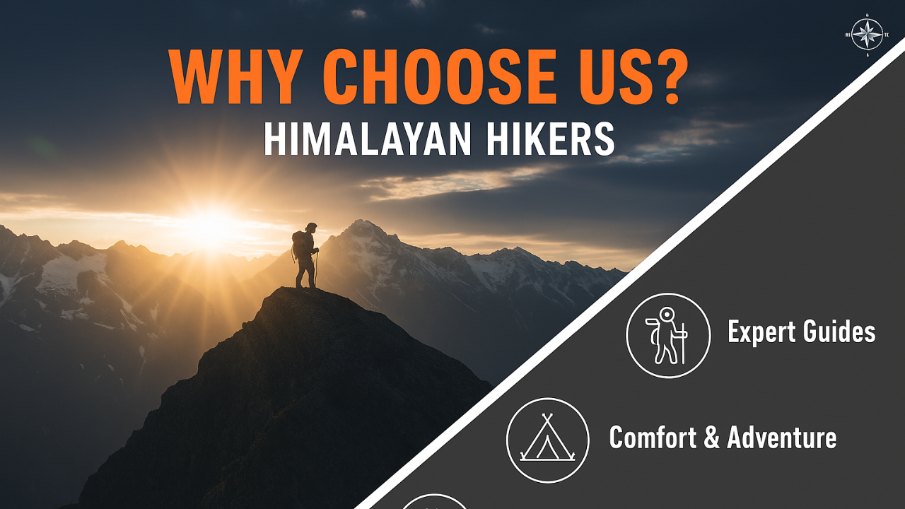
Why Himalayan Hikers is the gold standard for this specific high-altitude challenge
Bali Pass Trek is a different ballgame compared to a standard trek. Bali Pass 4,950 m is a technical "Crossover" trek that connects the Tons Valley to the Yamuna Valley.
1. Technical Safety & Peak Protocol
Bali Pass isn't just a walk; it involves 60-degree descent on snow and scree. Safety here requires more than just a first-aid kit.
- NIM Certified Technical Leads: Our leaders are trained at the Nehru Institute of Mountaineering (IMF Indian mountaineering foundation) with Local team For Bali Pass. They aren't just guides; they are technical experts who know how to fix ropes and cut steps in hard ice.
- The "Pass-Day" Strategy: The push from Odari to Damni via the Pass is grueling. We start as early as 4:00 AM to ensure we cross the snow bridge before the sun softens the ice—a critical safety window.
- Advanced Medical Support: Given the 4,950 m altitude, we carry medical-grade Oxygen, Gamow bags (on request for large groups), and constant pulse-oximetry monitoring at every camp (Ruinsara Tal, Odari).
- Himalayan Hikers Private Safety Equipment: Helmet, Ice axe, Rope, Gaiters, Spikes, and more.
2. The "Sankri to Janki Chatti" Logistics
Bali Pass is a one-way crossing. We handle the complex logistics of your transition from the Tons Valley to the Yamuna Valley seamlessly.
- Basecamp Comfort: Your journey begins at The Grand Shiva Home Stay in Sankri—our own property. You get a real bed, a hot meal, and a final technical briefing before heading into the wild.
- High-Altitude Shelters: We use specialized North Face-style 4-season Dome tents. At the Odari camp (the cave site), temperatures can drop to -10°C; our sleeping bags are rated for these extreme sub-zero conditions.
- Evacuation Readiness: We maintain a dedicated communication link with Janki Chatti and Yamunotri for the exit phase, ensuring transport is waiting when you descend from the heights.
3. Nutrition for High-Altitude Survival
On Bali Pass, you burn nearly 4,000–5,000 calories on the summit day.
- Thermogenic Diet: Our menu includes ginger soups, garlic-heavy dal, fruits (to aid natural acclimatization), and high-energy snacks like nuts and chocolates for the final ascent.
- Hydration Command: We enforce the "5L Rule." Our kitchen staff provides warm water even at the highest camps to ensure you don't get dehydrated in the freezing wind.
Bali Pass Enhanced Technical Safety Table
| Safety Feature | Benefit to the Trekker | The Himalayan Hikers Edge |
|---|---|---|
| Fixed Ropes & Ice Axe | Safety on the 70-degree steep descent to Yamunotri. | Our guides are experts in "Step Cutting" and rope anchoring in technical terrain. |
| Crampons/Micro-spikes | Traction on the slippery Bali Pass glacier. | High-quality, tested gear provided to every trekker for the summit push. |
| Acclimatization at Ruinsara Tal | Reduces AMS risk significantly. | We spend an extra night at the stunning Ruinsara Tal 3,350 m to prep your lungs. |
| Satellite/Radio Link | Critical for weather updates at the Pass. | Constant contact between Odari Base and Sankri HQ to monitor "Window Weather." |
Why We Are Different Bali Pass
| Feature | Other Big Agencies | Himalayan Hikers |
|---|---|---|
| Route Knowledge | Follow standard trails. No good idea | Local Legends: Our guides grew up in these mountains; they know "hidden" escape routes if the weather turns. |
| Campsite Quality | Generic crowded sites. | Strategic Locations: We pick wind-shielded spots at Odari to ensure you actually sleep before the big climb. |
| Technical Gear | Often rented/basic. | Pro-Grade: We own our equipment, ensuring every carabiner and rope is safety-checked. |
| The Exit | You are left at the road-head. | Full Cycle: We manage your transition from the Yamunotri side back to Dehradun drop. |
The "Yamunotri" Finish
While others treat the trek as over at the top of the pass, we know the descent to Yamunotri is the hardest part. Our guides stay by your side, literally "spotting" every step on the steep scree slopes until you reach the safety of the forest line or Jankichatti Road head last point.
| Category | Details |
|---|---|
| Transport | Dehradun to Dehradun round-trip via Tempo Traveller (Pickup & Drop) |
| Permits & Entry | Forest Permit and Entrance Fees |
| Accommodation | Homestay, Tented Accommodation on Twin / Tripple Sharing |
| Meals | Breakfast, Lunch, Tea, Coffee, Snacks, Soup, Dinner (All meals included) |
| Camping Gear | High-Quality Dome Tents, Sleeping Bags, Mattress, Liner |
| Sanitation Setup | Separate Toilet Tents (Ladies & Gents), Dining Tent, Dining Table, Camping Chair |
| Support Staff | Kitchen Team, Trek Helpers |
| Communication Tools | Radio Walkie-Talkie |
| Trek Guides | Experienced Trek Leader & Technical Guide |
| Safety Equipment | Medical Kit, Oxygen Cylinders, Pulse Oximeter |
| Trekking Equipment | Crampons, Gaiters, Helmate , Ice ax |
| Category | Details |
|---|---|
| Meals (Not Included) | – Day 1: En route Breakfast & Lunch to base camp– Day 8: En route Lunch & Dinner (not included) |
| Insurance & Documents | – Personal Insurance– Medical Certificate (Mandatory) |
| Personal Essentials | – Personal Toiletry Items– Personal Medical Kit |
| Porter Service | – Porter fee: ₹500 per day (to be paid directly at Sankri base camp)– Minimum bag weight for porter: 8 kg |
| Foreign Nationals | – ₹2800 extra for trekking permit– Passport and valid Visa required |
Important Note
Himalayan Hikers offers both online and offline booking options for their treks. Here’s a breakdown of both options:
1. Online Booking:
- Website: Himalayan Hikers has an official website where trekkers can browse through different treks, check details (itineraries, costs, difficulty level, etc.), and make bookings. Payment gateways are integrated for secure online transactions.
- Third-Party Platforms: They might also be listed on various trekking or adventure booking platforms, where you can compare prices, read reviews, and make bookings.
- Email Communication: Trekkers can inquire about treks via email and complete the booking process online, following email communication and payment.
2. Offline Booking:
- Direct Office Visit: Himalayan Hikers has physical offices (especially in Uttarakhand), where trekkers can visit in person, discuss treks, and complete bookings directly.
- Phone Booking: You can also call their office to make a booking. Details about payment methods, trek dates, and other logistics can be confirmed over the phone.
Yes, Himalayan Hikers requires a 25% advance payment for booking treks, Via- Google pay or UPI, Directly Himalayan Hikers Account with the remaining amount to be paid in cash at their branch office in Sankri before the trek starts. This payment structure is typical for ensuring that bookings are confirmed while allowing trekkers flexibility in completing the payment when they arrive.

The Bali Pass Trek is a high-altitude Himalayan trek in Uttarakhand that connects Har Ki Dun Valley to Yamunotri Valley. Known for its raw beauty, challenging trails, and panoramic views, it is one of the most adventurous treks in the Indian Himalayas.
Bali Pass is located in the Govind National Park, Uttarkashi district of Uttarakhand. The trek route passes through Sankri, Taluka, Osla, Har Ki Dun, Ruinsara Tal, and ends near Yamunotri.
The Bali Pass summit stands at an altitude of 4,950 meters (16,240 feet), making it a high-altitude and challenging trek.
- Summer (May – June): Best for clear skies, green meadows, and snow at higher altitudes.
- Post-monsoon (September – October): Crystal-clear mountain views and stable weather.
Not recommended in monsoon (July–August) due to heavy rainfall and landslides.
The trek generally takes 8–9 days, including travel to and from the base village Sankri.
Bali Pass is a difficult trek suitable only for experienced trekkers. It involves:
- Steep ascents and descents
- High-altitude walking above 4,500 m
- Snow patches and glacier crossings
- Trekking shoes with good grip
- Layered warm clothing (thermal, fleece, down jacket)
- Rain gear (poncho/jacket)
- Trekking pole, headlamp, gloves, and woolen socks
- Sunscreen, sunglasses, and water bottles
Yes, it is safe if done with proper preparation and a professional guide. Since it’s a high-altitude trek, risks like altitude sickness, steep trails, and unpredictable weather exist, so safety measures and acclimatization are essential.
- Crossing the Bali Pass Summit (4,950 m)
- Stunning views of peaks like Swargarohini, Bandarpoonch, and Kalanag
- Ruinsara Tal Lake – a high-altitude glacial lake
- Walking through Har Ki Dun and Yamunotri valleys
Trekkers should have prior high-altitude trekking experience and good stamina. Regular cardio exercises, stair climbing, and strength training are recommended 2–3 months before the trek.
No. This trek is recommended only for experienced trekkers because of its steep climbs, snow crossings, and high altitude. Beginners should attempt easier treks like Kedarkantha or Har Ki Dun first.
No. Winter trekking is not possible due to heavy snowfall, blocked routes, and extreme cold. Best months remain May–June and September–October.

.webp)