Announcement: Fixed departure groups for


In Buran Ghati Pass Trek, every day you get to see something different, the scenery you can see in the Buran Valley is amazing, here you will have a different experience on every camping site.
In the month of May, trekking here in Snow and Green Bugyal and the cool winds coming from the high hills will keep pulling you more and more in this trek.
The special stop of this trek is Chandranahan Lake, this is a beautiful lake which is in the middle of two hills. Elevation of about 4,260 m (13,980 ft) above sea level.
Another special feature of this trek is that it starts from Junglik village and ends at Barua Road head. Due to this, you are not going to feel the same on this trek anywhere, every day you are waking up differently.
About – Janglik Village in Buran Ghati Trek
The base camp of the Janglik is a beautiful small Village altitude of 2804 Meters. There are small shops and some homestays, Witness unique wooden houses made of Deodar wood.
You can get most of the things in Janglik is the main base camp of Buran Ghati Pass Trek you will start trekking here.
Attractions of Buran Ghati Trek
- Beautiful landscapes: The trek takes you through some of the most stunning landscapes of the region, including lush green forests, meadows, and snow-capped peaks.
- Buran Ghati Pass: The trek culminates at the Buran Ghati Pass, which is situated at an altitude of 15,000 feet. The pass offers breathtaking views of the surrounding mountains and valleys. River crossings: The trek involves crossing several rivers and streams, adding an element of adventure to the trek.
- Campsites: The trek offers opportunities for camping in some of the most picturesque locations, including beside glacial lakes and in high-altitude meadows.
- Cultural experience: The trek takes you through several remote villages, allowing you to experience the local culture and traditions of the region.
- Wildlife: The trek is home to a variety of wildlife, including Himalayan bears, snow leopards, and musk deer.
Overall, the Buran Ghati Pass Trek is a must-do for adventure enthusiasts looking for a challenging trek with stunning scenery and a unique cultural experience.
- Consequently, Buran Pass offers 360-degree views.
- On the other hand, enjoy doing 5 snow slides, which is the most adventurous part of this trek.
- In addition, enjoy Rappelling down the snow wall.
- During the trek, explore the lush green meadows of Dayara which bloom with wildflowers.
- Afterward, visit Chandranahan Lake.
- Come across numerous streams on the way.
- Further, pass through mixed forests and you will find a plethora of colorful flowers and shrubs.
At the end, go through Barua village, where there are many fruit orchards.
About Shimla in Buran Ghati Trek
Shimla is the capital of Himachal Pradesh, swathed by Rhododendrons, Oaks and Firs. It is the most loved hill station in India.
The fascinating beauty of Shimla even impressed the Bruisers and they declared it as the “Summer Capital” of British India. Apart from colonial buildings, there is high snow-covered Himalayas looming in the backdrop.
In Short, this capital city is blessed with enormous gifts which makes it one of the best destinations in India. Shimla is a starting pickup point of the Buran Ghati Pass Trek.
Why to choose Buran Ghati Trek?
- Scenic Beauty: The trek offers breathtaking views of the Himalayan landscape, including lush meadows, dense forests, pristine rivers, and stunning mountain peaks. The landscapes are especially vibrant and picturesque during the post-monsoon season, making it a visual delight for trekkers and nature lovers.
- Adventure: The trek is known for its adventure quotient, with challenging terrain, river crossings, and the excitement of crossing the Buran Ghati Pass. The presence of snowfields and varied trail conditions add an adventurous element to the trek.
- Off-the-Beaten-Path: Buran Ghati is a less-visited trekking route, which means it offers a more peaceful and remote experience compared to more popular treks. You can enjoy the tranquility of nature and escape from the crowds.
- Cultural Experience: The trek takes you through remote villages and offers opportunities to interact with the local inhabitants. This provides insights into the traditional Himalayan way of life and culture.
- Wildlife: The region is home to diverse flora and fauna. Trekkers may have the chance to spot various bird species and other wildlife along the trail.
- Challenge: For experienced trekkers, the Buran Ghati trek is a challenge that tests their physical fitness and trekking skills. Crossing the pass and navigating the varied terrain can be a rewarding test of one’s capabilities.
- Photography: The stunning landscapes and panoramic views make it an ideal destination for photography enthusiasts. The ever-changing natural beauty provides endless opportunities for capturing memorable shots.
- Sense of Achievement: Completing the Buran Ghati Trek is a significant accomplishment. Trekkers often derive a sense of achievement and personal growth from conquering the challenges posed by the trek.
See firstly, the trekking distance is a total of by taxi 375 Km and on foot 29 km which is to be covered in 6 nights and 07 Days.
Buran Ghati pass is the best Himachal Pradesh this is the best trek for Experienced people Altitudes is 15000 feet.
Need proper gear & clothing for sub-zero temperature winter?
- You get to see so many heavenly bodies in one place like the panoramic view of the Himalayan ranges, Himachal Pradesh meadows, one of the beautiful pine forests, Apple orchids different variety of flora and fauna surpassing through bona fide Himachal and Kinnaur heritage and culture.
- Do spare time in Interaction with locals, and you will get to know about some of the ancient tales of Indian mythology. And our Himachal and Kinnaur Cultures.
- Beautiful landscapes so carry proper photo gear and extra battery backup.
- The backpack should not exceed 10 to 12 kg only.
The weather conditions during the Buran Ghati Trek can vary depending on the time of year you choose to undertake the trek.
Here’s a general overview of the weather conditions during the Trek:
Pre-Monsoon Season (May to June):
- May and June are early summer months in the region.
- At lower altitudes, daytime temperatures can range from 10°C to 20°C (50°F to 68°F).
- Nights and higher altitudes can be colder, and temperatures can drop below freezing.
- There may be snow at higher altitudes, especially as you approach and cross the Buran Ghati Pass.
- The weather is relatively stable, but there’s still a risk of occasional rain and snowfall.
- Be prepared for rapidly changing weather conditions.
Post-Monsoon Season (September to October):
- September and October are considered the best time for the Buran Ghati Trek.
- Daytime temperatures are similar to the pre-monsoon season, ranging from 10°C to 20°C (50°F to 68°F) at lower altitudes.
- The weather is typically stable with clear skies, making it the ideal time for trekking.
- The landscapes are at their most vibrant, with lush meadows and blooming alpine flowers.
- There may still be snow at higher altitudes, especially near the pass.
Monsoon Season (July to August):
- The monsoon season in July and August is not recommended for trekking in the region.
- Heavy rainfall is common, leading to slippery and dangerous trail conditions, landslides, and swollen rivers.
- The risk of avalanches is also higher in this season.
Buran Ghati Trek Complete Guide
Our mission has always been to ensure that no trekker steps into the Himalayas without the right perspective. A trek is not just a checklist of summits; it is a serious commitment to the outdoors. Having the right information is what separates a reckless climb from a soulful journey.
This section serves as your definitive manual for the Buran Ghati Trek. We have distilled years of mountain experience and real-time feedback into this guide to give you a clear, honest picture of the trail.
We provide this depth of information because we want you to be more than just a visitor—we want you to be a prepared, responsible trekker who respects the mountains as much as we do.
Day 1: Pickup from Shimla at 7:30 AM, drive to Janglik village by taxi
Drive Distance: 160 km | Duration: 8–9 hrs | Altitude: 2,804 m | Stay: Overnight stay in Homestay (Janglik)
Day 2: Trek from Janglik village to Dayara Thach
Trek Distance: 4 km | Duration: 4–5 hrs | Altitude: 3,376 m | Stay: Overnight stay in Camp (Twin sharing)
Day 3: Trek from Dayara Thach to Litham
Trek Distance: 3 km | Duration: 3–4 hrs | Altitude: 3,578 m | Stay: Overnight stay in Camp (Twin sharing)
Day 4: Short Hike to Chandranahan Lake and return to Litham
Trek Distance: 6 km | Duration: 4–5 hrs | Altitude: 4,327 m | Stay: Overnight stay in Camp (Twin sharing)
Day 5: Trek from Litham to Dhunda
Trek Distance: 4 km | Duration: 6–7 hrs | Altitude: 4,075 m | Stay: Overnight stay in Camp (Twin sharing)
Day 6: Trek from Dhunda to Buran Pass and descend to River Camp
Trek Distance: 8 km | Duration: 7–8 hrs | Altitude: 4,572 m (Pass), 3,597 m (Camp) | Stay: Overnight stay in Camp (Twin sharing)
Day 7: Trek from River Camp to Barua and same day drive to Shimla
Trek Distance: 5 km | Drive Distance: 275 km
Day 1
Day 2
Day 3
Day 4
Day 5
Day 6
Day 7
Day 1 : Pickup to you from Shimla Drive to Janglik village by taxi (160 Km) (6/7 Hours) Altitude – 2,804 Meter
Total distance – 160 km – 6/7 Hours journey | Mode of journey – By taxi | Altitude Janglik – 2804 Meter Night stay – Home stay at Janglik Village
The vehicles are arranged from Shimla and the journey starts from there. Cover 160 km’s by going through some fable tourist attraction like Shimla, Rohru Fall by following the route through Janglik Village.
Enjoy the drive along the clear bluish Pabba River and witness the changing sights and quaint villages of Himachal. Crossing Pabbar leads to Diude and from Diude a short hike will take you to Janglik Village Overnight stay our home stay.
Day 2 : Trek from Janglik village to Dayara Thach
Total distance – 04 km – 4/5 Hours journey | Mode of journey – On foot | Altitude Dayara Thach – 3376 Meter | Night Stay – Our Camp site – on twin share basis
Start the trek by coming out of the wheat fields, bid goodbye to the last few Diude huts. Further you gain altitude and Tangle, Diude and other pretty villages can be seen clearly. Enter the forest of pine and oaks and ascend gradually.
After half an hour hike, the tree line recedes and you come across stretch of meadows. Climb up and reach the hill with mountain views on one side and lush trees on another. From here descend gradually on a wide trail.
After an hour again enter the dense pine and oak forest, walk under the shade of trees, listen to the crumbling of leaves and move further.
Before reaching Dayara the trail climbs up gradually. Reach the campsite, setup your tents and sleep comfortably. Enjoy trekking life with us
Day 3 : Trek from Dayara Thach to Litham camp (03 km) (3/4 Hours) (3578 Meter)
Trek Distance – 03 km – 3/4 Hours journey | Mode of journey – On foot | Altitude Litham – 3578 Meter | Night Stay – Our Camp site – on twin share basis
After breakfast, explore the Dayara meadows in the morning. Today, the trail from Dayara to Litham goes through thick forests, alluring green meadows and clear streams. Through meadows trail head towards Gunas Pass and after fifteen minutes enter the pine forest. Cross a stream and exit the forest section with delicious views of Dhauladhar range and Gunas Pass.
Ahead the grasslands look wonderful and magical, after half an hour the trail makes its way through another forest of Bhoj. Descend through this section and reach a stream from where Litham is clearly visible. The trail after the meadows goes to Chandranahan stream which needs to be crossed before reaching Litham.
Cross it and reach your campsite, there are plenty of streams across Litham. From here get mesmerized by the mind boggling mountain views. Towards left you can see the Chandranahan Waterfall and ahead lies Chandranahan Lake. Towards right are cliffs with snow patches behind which lies Rupin valley and in front are snow-covered mountains at their back lies Buran Ghati.
This is the last meadow on this trek, a wide one. Setup your here, relish the beautiful views and then retire for the night.
Day 4 : Short hike to Chandranahan Lake (4327 Meter) Explore some time here and back to Litham camp
Trek Distance – 06 km – 4/5 Hours journey | Mode of journey – On foot | Altitude Litham – 3578 Meter | Night Stay – Camp site – on twin share basis
Chandranahan is a small glacial lake amidst mountains and snow flanks feed this Lake. Take the shepherds trail to reach the Ridge Top and head towards the waterfall’s snout. In one hour you can reach the Lake but the journey gets difficult after the snout.
Witness the alpine valley and delicious views! The setting of this Lake is idyllic, grassy patches are in middle and small waterfalls turn into small streams. There are rough rocks which mark the lake, look at the settings and head back to Litham.
Descent is steep till Litham, make sure you start early to Chandranahan Lake so you can reach there at mid-day. Overnight stay camp
Day 5 : Trek from Litham camp to Dhunda Camp
Trek Distance – 04 km – 4/5 Hours journey | Mode of journey – On Foot | Altitude Dhunda camp – 4075 Meter | Night Stay – Our Camp site – on twin share basis
Today after breakfast, the climb to the pass is steep but short and today Buran Pass will be visible on the way.
Dhauladhar range and Gunas Pass can be seen en route with. It is a setting in front of Latham’s green grasslands and cliffs Rupin valley.
Pabbar descends rapidly and the trail gets sharply an ascending one. The trail turns to a gorge valley when you follow the river’s left bank.
From here Buran Ghati comes into sight. The shepherds trail will lead you to Dhunda.
After one hour of climb, reach Dhunda’s ridge top. From the top enjoy the clear and magnificent views of Buran Ghati.
Reach the campsite; it lies amidst snow-capped mountains from all the sides. Even in late June there you can find the patches of snow everywhere.
Day 6 : Trek from Dhunda to Buran Ghati Pass (4572 Meter) and River camp.
Total distance – 08 km – 7/8 Hours journey | Mode of journey – On foot | Altitude Buran Ghati Pass – 4572 Meter | Night Stay – Our Camp site – on twin share basis
Today wake up early because the distance is long, difficult Leave the campsite of Dhunda following the ridge and do boulder hopping to reach the base of the Buran Pass.
Reaching the Pass will take one hour from the base.
Today, ascent to Buran Ghati will be exhilarating. It is a narrow surface on the top, use ropes to descend because it can be very risky without it.Below you have to reach a snow field which is at a distance of 100 meters.
Slide down the surfaces which are present in series. Descending doesn’t take time on this trek, you lose the altitude which you gained in just one go.
Reach the end of snow line by losing 3000 feet. Descend through a ridge with blooming flowers and green shrubs.
The lush green valley views are really pleasant and the mountains towering high makes it look more beautiful. Ahead you will cross a stream, reach there in an hour.
Cross the stream and a hut will be visible. Today camp here and retire for the night.
Day 7 : Return : Trek from River camp to Barua (05 km) Same day Drive to Shimla
Trek Distance – 280 km – 10/11 Hours journey | Mode of journey – On foot – 05 km and by taxi – 275 km
Today on the trail come across diverse vegetation and get surprised by the changing landscapes. Follow the wide and frequently used Barua Khud’s path.
Descend and ahead see a stream meet Barua Khud, cross it over a bridge and explore the diverse vegetation. After hiking for one hour you reach apple orchards and further lies civilization.
There is a rock on the way from where the whole Barua village can be seen.
Enter this quaint Barua village there are many fruit orchards. Descend through it and now the trail gets you to the bridge over Barua Khud.
Halt here then leave for Shimla, vehicles will be arranged for you Himalayan Hikers
How Difficult is Buran Ghati Pass Trek
The Buran Ghati Pass Trek is considered to be a moderately difficult to challenging trek.
Here are some factors that contribute to its level of difficulty:
- Altitude Gain: The trek involves a significant altitude gain. You start from relatively lower altitudes and ascend to over 15,000 feet (4,572 meters) when crossing the Buran Ghati Pass. Trekking at high altitudes can be physically demanding and may lead to altitude-related issues, so proper acclimatization is essential.
- Length: The trek typically spans over a week, covering a distance of approximately 37-40 miles (60-65 kilometers) one way. The long duration and distance can be physically demanding, and trekkers should be in good physical shape.
- Weather Variability: The weather in the Himalayas can be unpredictable, even during the best trekking seasons. Trekkers should be prepared for sudden weather changes, including rain and snowfall, and have suitable clothing and gear.
- Trail Conditions: The trail includes steep ascents and descents, rocky paths, and occasional snowfields, especially when approaching and crossing the Buran Ghati Pass. Navigating these terrain types can be physically challenging.
- Avalanche Risk: Depending on the season, there may be an increased risk of avalanches near the pass, particularly in the early summer months. Trekkers should be aware of avalanche safety and take necessary precautions.
- River Crossings: The trek includes several river crossings, which can be challenging during high water flow conditions. Trekkers should be cautious and ensure they have the necessary equipment and guidance for safe crossings.
- Remote Location: The Buran Ghati trek takes you through remote and less-visited areas. This means that access to emergency services and amenities may be limited. Trekkers should be self-reliant and prepared for emergencies.
- Physical Fitness: Given the challenging aspects of the trek, trekkers are advised to be in good physical condition with prior trekking experience.
Buran Ghati Pass safe for Beginners?
Yes, Buran Ghati Pass Trek is a safe trek if you are going with a good trekking team which you must know before booking yourself, It is important for you to know whether the bow trekking organization with which we are going is right or not, recommended for beginners or novice hikers due to its moderate to challenging nature and the various factors that can make it a demanding trek. Here are some reasons why it may not be the best choice for beginners.
Age Limit: The minimum age required to trek Buran Ghati Pass is 12 years and a maximum of 55 years. The rest depends on your fitness.
Best Time to Visit Buran Ghati Pass Trek?
Buran Ghati Pass trek is a very beautiful and Gradual uphill trek in the Himalayas, The Buran Ghati Pass trek is great for those people who have a great passion for mountaineering and consider it a special purpose in their life.
The best time to visit the Buran Ghati trek is during the post-monsoon season, which typically spans from late September to early October. This period is considered the ideal time for this trek for several reasons
- Weather: The post-monsoon season offers relatively stable and clear weather conditions in the region. The chances of heavy rainfall, snow, or adverse weather are reduced during this time, making trekking safer and more enjoyable.
- Landscape: The post-monsoon season brings lush, green landscapes with blooming alpine flowers and vibrant meadows. The trail is at its most scenic, offering breathtaking views of the surrounding mountains and valleys.
- Snow: While there may still be some snow at higher altitudes, it is typically manageable during this season. Trekkers can experience the thrill of crossing snowfields without the extreme cold and risk associated with winter trekking.
- Moderate Temperatures: Daytime temperatures during the post-monsoon season are usually comfortable for trekking, with temperatures ranging from 10°C to 20°C (50°F to 68°F) at lower altitudes. However, nights can be cold, so warm clothing is necessary.
- Wildlife: This season also provides opportunities to spot local wildlife, including birds and other fauna that are active in the region.
Buran Ghati Pass Trek in the month of May or June?
Trekking to Buran Ghati in May or June can be a different experience compared to the post-monsoon season, which is generally considered the best time for this trek.
- Snow: During May and June, significant snow can still be present at higher altitudes. This means that you are likely to encounter snow-covered trails and snowfields, which can add a unique challenge to the trek. Trekking in snow requires specialized equipment like gaiters, ice axes, and crampons, and you should be prepared for colder temperatures.
- Weather: While the days at lower elevations may be relatively warm, the weather in the mountains can be unpredictable. Be prepared for sudden weather changes, including rain or snowfall, and make sure to have suitable clothing and gear for such conditions.
- Avalanche Risk: In the early summer months, there can be an increased risk of avalanches in certain sections of the trek, especially near the Buran Ghati Pass. It’s crucial to have knowledge of avalanche safety and the local conditions if you plan to trek during this time.
- Camping and Accommodation: Some of the higher-altitude campsites may not be accessible in May and June due to snow cover. This may affect your itinerary and campsite choices. Some campsites may not be as lush and green as they are in the post-monsoon season.
Buran Ghati Pass Trek in July and August?
In the months of July and August, you will get to see beautiful flowers and green Bugyal beautiful Mountain range, this trek looks very beautiful in monsoon.
You also get a chance to do Chandranahane Lake along with this trek, for which people trek separately, you complete two treks with a single trek which can be very good.
There is some rain in the monsoon months of July and August, trek but it also has its own fun in trekking. and Not many people come here in monsoon, so you can have a peaceful atmosphere here.
Buran Ghati Pass Trek in September or October
Trekking to Buran Ghati Pass in September or October is generally considered an excellent time to experience this trek.
- Ideal Weather: September and October offer the best weather conditions for the Buran Ghati trek. The monsoon season is over, and the winter chill has not yet set in. Days are generally pleasant with temperatures ranging from 10°C to 20°C (50°F to 68°F) at lower altitudes, making it comfortable for trekking. Nights can be cold, so you’ll need warm clothing.
- Clear Skies: The skies are relatively clear, providing excellent visibility for enjoying the breathtaking landscapes and mountain views. You’ll have the opportunity to capture beautiful photographs of the surrounding scenery.
- Vibrant Landscapes: The post-monsoon season brings lush greenery and colorful blooms to the meadows and forests. The region comes alive with blooming alpine flowers, adding to the overall beauty of the trek. The landscapes are at their most vibrant during this time.
- Snow at Higher Altitudes: While lower altitudes may not have much snow, you can expect to encounter snow at higher elevations, particularly as you approach the Buran Ghati Pass. This adds an exciting element to the trek without the extreme cold of winter.
- Stable Conditions: The weather is relatively stable, and the chances of heavy rainfall or snowfall are minimal. This ensures a safer and more enjoyable trekking experience.
- Camping and Accommodation: All the campsites are accessible during this season, and you can enjoy lush and picturesque camping spots along the trail.
- Wildlife Sightings: You might have the opportunity to spot local wildlife, including birds and other fauna that are active during this time.
How to Reach Shimla for Buran Ghati Trek with Himalayan Hikers
To reach Shimla for your Buran Ghati Trek with Himalayan Hikers, you need to arrive at the assembly point in the city by early morning on Day 1. Himalayan Hikers coordinates transport from Shimla to the base camp at Janglik Village Started point Buran Ghati Trek
Assembly Point & Time
- Location: Old Bus Stand, Shimla.
- Pickup Time: Between 7:00 AM and 7:30 AM on Day 1.
- Final Destination: Janglik Village (approx. 160 km / 8-hour drive).
How to Reach Shimla
1. By Train (The Most Scenic Route)
- Nearest Major Station: Kalka (KLK).
- From Delhi: Take the Kalka Shatabdi or Himalayan Queen from New Delhi Railway Station. These trains are timed to connect with the toy train.
- From Kalka to Shimla The Toy Train: A UNESCO World Heritage ride (5–6 hours). It’s beautiful but slow.
- Taxi/Bus: If you are short on time, a taxi from Kalka takes about 3 hours to reach Shimla.
2. By Road (The Most Convenient Route)
- From Delhi: Most trekkers take an overnight Volvo bus from ISBT Kashmiri Gate or Majnu-ka-Tilla. Buses leave between 8:00 PM and 11:00 PM and reach Shimla around 5:00 AM to 7:00 AM—perfectly timed for the Himalayan Hikers pickup.
- From Chandigarh: Frequent buses and taxis are available from the Sector 43 Bus Stand (approx. 3.5 hours).
3. By Air
- Shimla Airport (Jubbarhatti): Limited flights and often cancelled due to weather.
- Chandigarh Airport (IXC): The most reliable airport. After landing, take a taxi or bus to Shimla (approx. 4 hours).
Pro-Tips for Your Group
- Arrive a Day Early: It is highly recommended to reach Shimla on "Day 0." This allows you to rest after a long journey and ensures you don't miss the 7:00 AM pickup due to bus delays.
- Last-Minute Supplies: Use your evening in Shimla to buy any last-minute trekking gear (socks, raincoats) at the Mall Road or Lakkar Bazar.
- Connectivity: Shimla is your last stop with high-speed internet. Mobile network becomes extremely spotty once you head toward Janglik base camp.

Essential Gear for the Buran Ghati Pass Trek Packing List
1. Trekking Gear & Bags
- Main Backpack (50–60 Liters): Must have good hip support and a rain cover.
- Daypack (20 Liters): Essential if you plan to offload your main bag, carries water, snacks, and a jacket.
- Trekking Poles: Highly recommended for stability on snowy slopes.
2. Clothing (The Layering System)
- Base Layer (2-3 Pairs): Quick-dry, moisture-wicking thermals (top and bottom).
- Mid Layer (2): Fleece jackets or sweaters for insulation.
- Outer Layer (2): A high-quality padded down jacket (rated for -10°C).
- Trekking Pants (2): Water-resistant and windproof pants. Avoid jeans at all costs.
- T-shirts (3): Collared, full-sleeve dry-fit tees to prevent sunburst on the neck.
3. Footwear & Socks
- Trekking Boots: High-anchor, waterproof boots with good grip Decathlon Forclaz or similar MH 100) Asain, Jonmart hiking Shoes .
- Woolen Socks (4 Pairs): For sleeping and extra warmth at night.
- Cotton Socks (4 Pairs): For trekking during the day.
4. Headwear & Accessories
- Sun Cap: To protect against UV rays during the day.
- Woolen Cap/Balaclava: Must cover your ears to prevent heat loss.
- Neck Warmer/Buff: Protects your face from cold winds.
- Gloves: One pair of fleece liners and one pair of waterproof outer gloves.
- Sunglasses: Polarized/UV protected to prevent snow blindness.
5. Personal Hygiene & Toiletries
- Sunscreen (SPF 50+) and Lip Balm.
- Moisturizer and Sanitizer.
- Toilet paper and Biodegradable wet wipes.
- Toothbrush, Toothpaste, and a small quick-dry towel.
6. Health & First Aid
- Personal Medikit: Band-aids, crepe bandage, and antiseptic.
- Anti-Altitude Sickness: Diamox (consult your doctor first).
- Pain Relief: Volini spray or Moov.
- Water Purification: Tablets or a LifeStraw.
Quick Tips for a Successful Trek with Himalayan Hikers
- Hydration: Drink at least 3/4 liters of water daily to help with acclimatization.
- Batteries: Cold drains phone and camera batteries fast. Keep them inside your sleeping bag at night to keep them warm.
- Eco-Friendly: "Pack it in, pack it out." Don't leave any plastic on the trail.
Must-Have Medicines for Buran Ghati pass Trek
1. Altitude & Breathing
- Diamox (Acetazolamide): The most common medicine for AMS (Acute Mountain Sickness). It helps your body acclimatize faster.
- Note: Start a preventive dose only after consulting your doctor, as it is a diuretic.
- Camphor (Kapur): Carrying a small pouch of camphor to smell can help some people feel more comfortable while breathing in thin air.
2. Pain & Inflammation
- Combiflam / Ibuprofen: For muscle aches, joint pain, or body fever after a long day of climbing.
- Dolo 650 (Paracetamol): For mild fever or headaches (often a first sign of dehydration or AMS).
- Diclofenac Gel/Spray (Volini/Moov): Essential for calf muscle cramps or knee pain during the descent.
3. Digestive Health
- Digene / Pudin Hara: For acidity or bloating caused by heavy meals at high altitudes.
- Ondem (Ondansetron): For nausea or vomiting (common symptoms of altitude sickness).
- Eldoper / Nor-Metrogyl: For loose motions or stomach infections.
- ORS / Electral: To prevent dehydration. Mix one sachet in your water bottle every day.
4. Respiratory & Cold
- Ascoril/Alex Syrup (or Lozenges): For "Khonchi" (dry mountain cough) caused by cold, dry air.
- Cetirizine / Okacet: For allergic reactions or a runny nose.
- Avomine: If you get motion sickness during the bumpy 8/9-hour drive from Shimla to Jiskun Village.
5. First Aid Basics
- Band-aids & Cotton: For small nicks.
- Crepe Bandage: In case of a minor ankle sprain on the snowy trail.
- Betadine/Dettol: Antiseptic for any cuts.
- Anti-fungal Powder: To keep your feet dry and prevent fungal infections from wet socks.
Mandatory Document Checklist for Buran Ghati Trek
1. Government Identity Proof (Original + 2 Photocopies)
You must carry a valid, government-issued photo ID. This is required for forest check-posts at and Janglik village
- Accepted: Aadhar Card, Voter ID, Driver's License, or Passport.
- Note: Keep two photocopies handy as one will be submitted at the Forest Office for your entry permit.
- Trek Insurance mandatory
2. Medical Fitness Certificate
Himalayan Hikers prioritizes safety. You cannot start the trek without a certified medical report.
- Requirement: The certificate must be signed and stamped by a registered medical practitioner (MBBS Doctor).
- Validity: It should usually be issued within 15–30 days of the trek start date.
- Criteria: It should state that your blood pressure, heart rate, and lung health are normal for high-altitude trekking.
3. Disclaimer & Waiver Form
This is a standard indemnity bond provided by Himalayan Hikers.
- What it is: A document stating that you understand the risks of high-altitude trekking and are participating voluntarily.
- Process: You can usually download this from their website, sign it, and hand it over at the Janglik Base camp.

Expert-level Training & Safety Plan for Buran Ghati, specifically designed for Himalayan Hikers.
6-Week Buran Ghati "Technical Edge" Training Plan
Weeks 1-2: Building the "Engine" (Aerobic Base)
Running: 3-4 days a week. Target 5 km. Buran Ghati involves a steep ascent from Janglik to Dayara Thatch, you need sustained lung capacity.
Strength:
- Squats: 3 sets of 20. (Essential for the steep climb to Litham).
- Calf Raises: 3 sets of 25. (Protects your ankles on the rocky terrain of the Barua Valley).
Himalayan Hikers Logic: Your body must adapt to the "Oxygen Debt" you will face when we cross the 4,570 m ridge. Focus on rhythmic breathing.
Weeks 3-4: The "Wall" Prep (Lower Body & Stability)
Running: 4 days a week. Include Downhill Running. Buran Ghati has a very sharp descent into the Barua side; your knees must be "impact-ready."
Weight Factor: Walk 8 km with a 6-8 kg backpack to simulate carrying your personal gear.
Strength:
- Step-ups: 3 sets of 20 (Simulates the ascent toward the Dhunda base camp).
- Plank: 60-90 seconds. A strong core is the only thing that keeps you balanced while rappelling down the snow wall.
Weeks 5-6: Peak Technical Endurance (The Crossover Phase)
Target: Run 5 km in 30–32 minutes.
The "Final Test": A 15 km trek/walk on uneven terrain with a 9 kg backpack.
Technical Prep:
- Burpees: 3 sets of 12. (Builds the explosive power needed to kick steps into the frozen snow at the pass).
- Wall Sits: 2 minutes. (Builds the isometric strength required for the long descent into the forest).
1. Cardiovascular Endurance (The High-Altitude Heart)
The Buran Ghati trail rises quickly. You move from 9,000 ft to over 15,000ft in just a few days.
Target: Be able to run 5 km comfortably.
Incline Training: If on a treadmill, use a 10-12% incline to simulate the climb from Litham to the sacred Chandernahan Lakes.
2. Muscle Strength (The Descent Specialist)
The descent from Buran Ghati is more technical than Rupin Pass.
Lunges & Side-Lunges: Vital for the lateral movement required when navigating the boulder sections near the Barua glacier.
Upper Body: Focus on shoulders and lats. You will be using trekking poles and occasionally fixed ropes; your grip and arm strength matter.
3. Breathing & Lung Capacity
| Exercise | Target for Buran Ghati | Why it's different from Rupin Pass |
|---|---|---|
| Downhill Lunges | 3 Sets / 15 Reps | Buran has a steeper, more sustained descent than Rupin. |
| High-Intensity Interval (HIIT) | 20 Minutes | The final 500m to the Buran summit is a "vertical push" that requires short bursts of maximum energy. |
| Ankle Rotations | Daily | The descent through the Barua forest is over slippery roots and loose soil. |
| Core Stability | 2 Minute Plank | Essential for maintaining your center of gravity during the "Snow Slide." |
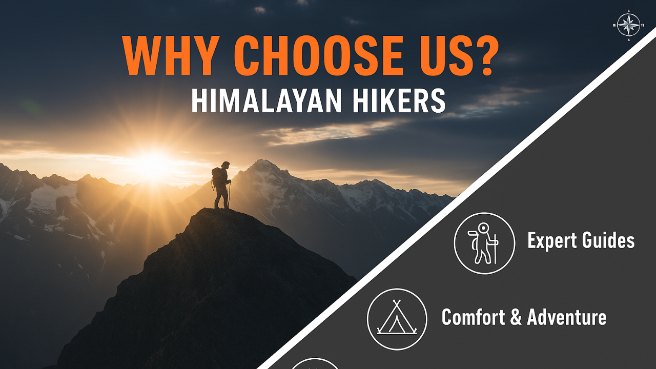
Why Choose Himalayan Hikers for Buran Ghati Trek?
- The "Vertical Wall" Safety: Unlike other groups that let trekkers slide uncontrollably, Himalayan Hikers' guides fix pro-grade ropes and use snow pickets to ensure a safe, technical descent.
- Chandernahan Lake Acclimatization: We include a mandatory excursion to the Chandernahan Lakes. This isn't just for the view—it's a "Climb High, Sleep Low" strategy that makes the final pass day much easier.
- Local Kinnauri Guides: Our guides are locals who know the Barua valley like the back of their hand. If the main trail is blocked by snow, they know the safe alternative ridges.
- Advanced Equipment: For Buran Ghati, we provide High-Traction Micro-spikes and Safety Helmets, ensuring that even in hard ice, your grip is iron-clad.
What to present at the Janglik Base Camp:
- The Fitness Log: Proof of your 5km run times and consistent stair climbing.
- Technical Awareness: Confirmation that you have watched our "Self-Arrest" safety video.
- Medical Clearance: Specifically checking for respiratory health and heart rate recovery.
Essential Buran Ghati Layering
The "Barua" Rain Shell: The Kinnauri side of the pass often catches sudden moisture. A 10,000mm breathable waterproof jacket is a must.
Technical Footwear: High-ankle waterproof boots with deep lugs (Vibram or equivalent) are mandatory for the technical snow-to-rock transition.
This is a suggestion that will help you on your trek, but if you are generally fit and healthy, you can prepare according to your own preferences. If you are regular trekker, come and join
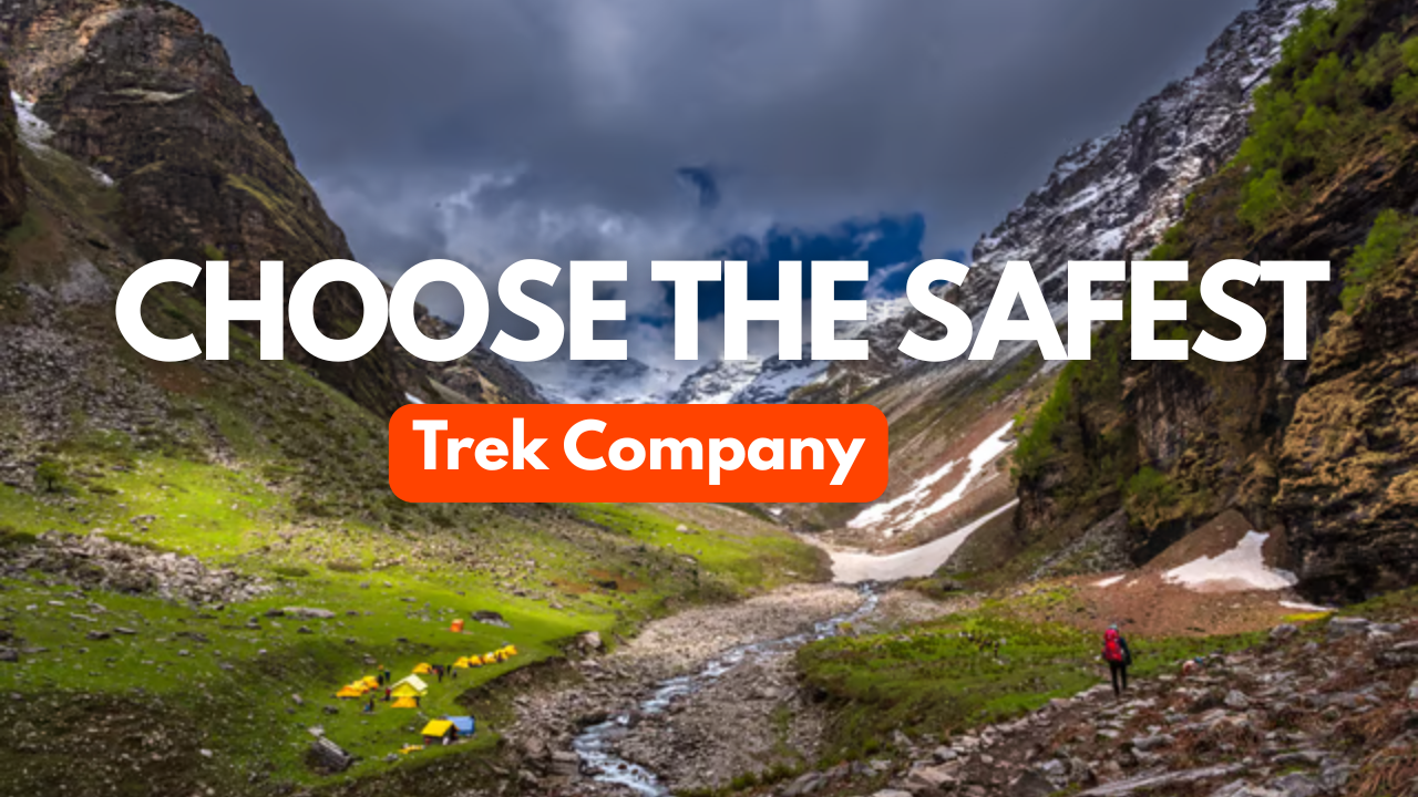
Why Himalayan Hikers is the Safest Choice for Buran Ghati Pass Trek
The Ultimate 4,570 m Beautiful Crossover
Buran Ghati Trek is a masterclass in Himalayan diversity, taking you from the ancient villages of Janglik to the high-altitude meadows of Dayara, and finally over the razor-sharp ridge into the Barua Valley. It is famous for its breathtaking "Wall of Snow" and the transition from lush greenery to a stark, alpine descent.
1. Technical Safety & The "Wall" Protocol
The defining feature of Buran Ghati is the steep descent from the pass. It isn't just a walk down; it often requires technical maneuvers.
- NIM & IMF Certified Technical Leads: Our guides are specialists in Technical Snow Craft. On the Buran Ghati descent, which can have a gradient of 60 to 70 degree our team sets up fixed ropes and uses snow pickets to ensure a controlled and safe descent for every trekker.
- The "Ice-Slide" Mastery: While sliding down the snow is fun; it can be dangerous without proper instruction. Our team teaches you the "Self-Arrest" technique using your hands or ice axes before you even reach the summit.
- Safety Gear Infrastructure: We provide high-quality Seat Harnesses, Carabiners, and Helmets specifically for the Buran Ghati pass day—gear that most standard agencies skip.
- Early Summit Strategy: We push for a 3:30 AM or 4:00 AM start. This ensures we reach the pass while the snow is firm enough for "Step Cutting" and finish the steep descent before the sun turns the snow into a slippery slush.
2. Expert Logistics: From Shimla to Kinnaur
Buran Ghati starts in the heart of Himachal and ends in the scenic Kinnaur region. We handle this transition with local finesse.
- Acclimatization at Dayara & Litham: We don't rush. We spend extra time at Litham (the base for Chandernahan Lake) to ensure your body is ready for the 15,000 ft altitude.
- High-End Expedition Tents: At the Dhunda campsite (the freezing base of the pass), we use reinforced geodesic tents to withstand high-altitude winds and heavy snowfall.
- The Barua Finish: Our trek ends in the beautiful village of Barua, famous for its apple orchards. We ensure your transport is ready the moment you hit the road-head, avoiding any long waits in the cold.
3. Nutrition for the Alpine Ascent
Crossing a pass like Buran Ghati requires immense physical stamina. Our menu is scientifically designed for endurance.
- High-Altitude Carb-Loading: We provide complex carbohydrates like oats and pasta for dinner before the pass day to give you slow-release energy for the 10-hour climb.
- Garlic & Hydration: To fight AMS (Acute Mountain Sickness), we serve garlic-infused hot soups and insist on a strict hydration protocol monitored by our trek leads.
Buran Ghati Technical Safety Table
| Safety Feature | Benefit to the Trekker | The Himalayan Hikers Edge |
|---|---|---|
| Fixed Ropes & Harness | Secure descent on the 70 degree snow wall. | We use climbing-grade ropes and harnesses for every trekker. |
| Technical Briefing | Prevents panic on steep slopes. | We conduct a "Snow-Drill" a day before the pass at Dhunda. |
| Oxygen & Oximeter | Early detection of altitude issues. | Twice-daily health checks (morning and evening). |
| Emergency Buffer | Safety during bad weather. | Our itineraries include a "Buffer Day" to wait for the perfect weather window. |
Why Himalayan Hikers is Different for Buran Ghati
| Feature | Standard Agencies | Himalayan Hikers |
|---|---|---|
| Descent Method | Casual sliding (risky). | Rappelling/Fixed Rope: Controlled and professional. |
| Campsite Quality | Basic tents. | 4-Season Alpine Tents: Built for sub-zero Kinnaur nights. |
| Trek Leaders | Seasonal freelancers. | Local Experts: Our team knows the hidden crevices of the Barua Glacier. |
| Chandernahan Visit | Often skipped to save time. | Full Experience: We include the trek to the 7 sacred lakes of Chandernahan. |
| Category | Details |
|---|---|
| Transport | Shimla to Shimla Round-Trip via Tempo Traveler (Pickup & Drop) |
| Permits & Entry | Forest Permit and Entrance Fees |
| Accommodation | Homestay, Tented Accommodation on Twin / Triple Sharing |
| Meals | Breakfast, Lunch, Tea, Coffee, Snacks, Soup, Dinner (All meals included) |
| Camping Gear | High-Quality Dome Tents, Sleeping Bags, Mattress, Liner |
| Sanitation Setup | Separate Toilet Tents (Ladies & Gents), Dining Tent, Dining Table, Camping Chair |
| Support Staff | Kitchen Team, Trek Helpers |
| Communication Tools | Radio Walkie-Talkie |
| Trek Guides | Experienced Trek Leader & Technical Guide |
| Safety Equipment | Medical Kit, Oxygen Cylinders, Pulse Oximeter |
| Trekking Equipment | Crampons, Gaiters, Helmate , Ice ax |
| Category | Details |
|---|---|
| Meals (Not Included) | – Day 1: En route Breakfast & Lunch to base camp – Day 7: En route Dinner (not included) |
| Insurance & Documents | – Personal Insurance– Medical Certificate (Mandatory) |
| Personal Essentials | – Personal Toiletry Items– Personal Medical Kit |
| Porter Service | – Porter fee: ₹500 per day (to be paid directly at Janglik base camp)– Minimum bag weight for porter: 8 kg |
| Foreign Nationals | – ₹2400 extra for trekking permit– Passport and valid Visa required |
Important Note
Himalayan Hikers offers both online and offline booking options for their treks. Here’s a breakdown of both options:
1. Online Booking:
- Website: Himalayan Hikers has an official website where trekkers can browse through different treks, check details (itineraries, costs, difficulty level, etc.), and make bookings. Payment gateways are integrated for secure online transactions.
- Third-Party Platforms: They might also be listed on various trekking or adventure booking platforms, where you can compare prices, read reviews, and make bookings.
- Email Communication: Trekkers can inquire about treks via email and complete the booking process online, following email communication and payment.
2. Offline Booking:
- Direct Office Visit: Himalayan Hikers has physical offices (especially in Uttarakhand), where trekkers can visit in person, discuss treks, and complete bookings directly.
- Phone Booking: You can also call their office to make a booking. Details about payment methods, trek dates, and other logistics can be confirmed over the phone.
Yes, Himalayan Hikers requires a 25% advance payment for booking treks, Via- Google pay or UPI, Directly Himalayan Hikers Account with the remaining amount to be paid in cash at their Basecamp office in Janglik village before the trek starts.

Unlike most passes that offer a gradual descent, Buran Ghati features a near-vertical 400-foot snow wall on the Kinnaur side. In early summer, trekkers often rappel or slide down this wall, making it one of the most adventurous "crossover" treks in India.
Buran Ghati Trek is Moderate to Difficult. While the first few days are a gentle walk through Dayara meadows, the pass-crossing day is grueling, involving a steep ascent to 15,000 ft and a technical descent. It is best suited for trekkers with at least one high-altitude experience.
- Max Altitude: 15,000 ft at the Buran Pass summit.
- Total Distance: Approximately 37–42 km, covered over 06 days of actual trekking.
There are two distinct windows:
- May to June: Best for snow lovers. You will find plenty of snow on the pass and experience the famous snow-wall slide.
- September to October: Ideal for photographers. The skies are crystal clear, and the forests of the Barua valley turn a stunning golden-orange.
It is a crossover trek that starts in the Pabbar Valley and ends in the Kinnaur Valley:
- Start Point: Janglik Village (accessible Fixed Departure with Himalayan hikers Group from Shimla).
- End Point: Barua Village (near Karcham/Sangla).
Yes, but with a caveat: you must be physically elite. If it’s your first trek, you should be able to run 5 km in under 30 minutes. If you are fit so you can do
Located at 13,900 ft, this is a cluster of seven glacial ponds. It is considered the sacred source of the Pabbar River. The hike to the lake on Day 4 serves as a crucial acclimatization day before the pass crossing.
During the May-June season, you will need microspikes, gaiters, and ice axes Rope provided by Himalayan Hikers). For the descent, fixed ropes and harnesses are used to safely rappel down the snow wall.
Connectivity is virtually non-existent after leaving Rohru or Chirgaon. You might get a faint BSNL signal at Janglik, but consider yourself "off the grid" until you reach Barua village on the final day.
No. The last ATM is in Rohru. You should withdraw all necessary cash in Shimla or Rohru before heading to the base camp at Janglik.
- Daytime: 10°C to 18°C (Pleasant for trekking).
- Nighttime: 5°C to -5°C (Can drop further to -10°C at the Dhunda campsite or the pass).
The descent to Barua village drops nearly 7,000 ft in two days. This can be hard on the knees. Using two trekking poles and practicing "lunges" during your pre-trek training is vital for knee stability.
Solo trekking is not recommended due to the technical nature of the Buran Pass and the lack of a defined trail on the glacier. Navigating the snow wall alone without safety ropes is highly dangerous.
The descent into the Kinnaur side takes you through some of the most beautiful apple orchards and pine forests in India. The architecture of Barua village, with its intricate wood carvings, offers a rich cultural contrast to the Pabbar side.
Due to the rapid ascent from Litham (11,700 ft) to the Pass (15,000 ft), some trekkers experience headaches, nausea, or loss of appetite. Proper hydration (4L+ water daily) and the acclimatization hike to Chandranahan Lake are your best defenses.