Announcement: Fixed departure groups for


Named after John Bicknell Auden of the Geological Survey of India, who first mapped this daunting gap in 1935, the pass remains one of the most challenging and technically demanding treks in the world. It connects the granite massifs of Gangotri III (6,577m) and Jogin I (6,465m), leading adventurers across the treacherous Khatling Glacier.
For those seeking to test their limits, Auden’s Col is the ultimate theater of adventure. At Himalayan Hikers, with over 35 years of experience leading expeditions in these mountains, we ensure that your journey through this "Death Zone" is backed by world-class safety and local wisdom.
Why Auden’s Col is the "Holy Grail" of Treks
1. The Trans-Himalayan Connection: This trek is one of the few routes that allows a traverse from Gangotri to Kedarnath. By crossing Auden’s Col and the subsequent Mayali Pass, trekkers connect two of the most sacred Char Dham pilgrimage sites via a route that very few human beings have ever stepped on.
2. A Masterclass in Glaciology: Navigating the Khatling Glacier is the highlight and the primary challenge of this expedition. It is a massive, moving river of ice filled with "lateral" and "medial" moraines and hidden crevasses. It requires trekkers to use technical skills like roping up and using ice axes—skills that define a true mountaineer.
3. Front-Row Seats to the Giants: The views here aren't just panoramic; they are intimate. You are within touching distance of:
- The Bhagirathi Sisters (I, II, and III)
- The Gangotri Group of peaks
- Kedarnath and Kedar Dome
- Jogin I and II
Phase 1: The Approach (Dehradun to Gangotri)
The journey begins in Dehradun, driving through the winding roads of the Shivaliks to Gangotri (3,048m). We spend two days here for mandatory acclimatization. We visit the holy Gangotri Temple and take short hikes to ensure your lungs are ready for the 5,000m+ jump.
Phase 2: Entering the Wilderness (Gangotri to Rudugaira Base Camp)
Leaving the pilgrimage trails behind, we head toward Nala Camp and then Rudugaira Base Camp. The terrain shifts from dense alpine forests of Deodar and Pine to lush meadows (bugyals) filled with wildflowers. As we ascend, the greenery fades, replaced by the stark, grey beauty of the moraines.
Phase 3: The Technical Push (Auden’s Col Base Camp)
This is where the trek transforms into an expedition. We establish a high camp near the foot of the Col. Here, the Himalayan Hikers technical team conducts a mandatory workshop on:
- Using crampons and micro-spikes.
- Rope management and "anchoring."
- Self-arrest techniques using ice axes.
Phase 4: The Summit of the Pass (The Crossing)
The day of the crossing starts at 3:00 AM. In the freezing dark, we navigate steep snow slopes (often 40-50 degrees). Reaching the Col at 5,490m at sunrise is a spiritual experience. The view of the sun hitting the peaks of the Garhwal range is a victory few can claim.
Phase 5: The Khatling Descent and Mayali Pass
The descent is more dangerous than the climb. We abseil down the southern face toward the Khatling Glacier. This section is a maze of ice. After surviving the glacier, we cross the Mayali Pass (4,990m), which offers a stunning view of Vasuki Tal, before descending into the Mandakini Valley toward Kedarnath.
The Hazards: Why Professional Guidance is Non-Negotiable
Auden’s Col is "explosively difficult." Without expert intervention, the risks are life-threatening:
- Crevasses: The Khatling Glacier is notorious for "hidden" crevasses covered by thin snow bridges. One wrong step can be fatal. Himalayan Hikers uses a "Roped Team" strategy to ensure safety.
- Rockfalls: The area around the Col is prone to falling rocks as the sun melts the ice. Our guides have the "mountain eyes" to spot these zones and time our movement safely.
- Altitude Sickness (AMS): At nearly 5,500m, HAPE and HACE are real threats. We carry supplemental oxygen cylinders, pulse oximeters, and a comprehensive medical kit on every trek.
- Whiteouts: Weather in the Garhwal can turn in minutes. Our guides are trained in navigation during zero-visibility conditions using high-end GPS and traditional mountain wayfinding.
Required Technical Gear and Preparation
When you trek with Himalayan Hikers, we provide high-quality, expedition-grade equipment. However, trekkers must be prepared.
The Himalayan Hikers Kit:
- Four-Season Tents: Reinforced to withstand high-velocity winds and heavy snow.
- High-Altitude Sleeping Bags: Rated for temperatures as low as -20°C.
- Technical Hardware: Static and dynamic ropes, snow stakes, ice screws, and carabiners.
What You Need to Bring:
- Footwear: Double-layered mountaineering boots or high-quality trekking boots compatible with crampons.
- Physical Fitness: You should be able to run 10km in under 60 minutes. Your core strength and lung capacity are your greatest assets on the steep inclines of the Col.
Auden's Col Trek Complete Guide
Our mission has always been to ensure that no trekker steps into the Himalayas without the right perspective. A trek is not just a checklist of summits; it is a serious commitment to the outdoors. Having the right information is what separates a reckless climb from a soulful journey.
This section serves as your definitive manual for the Auden's Col Trek. We have distilled years of mountain experience and real-time feedback into this guide to give you a clear, honest picture of the trail.
We provide this depth of information because we want you to be more than just a visitor—we want you to be a prepared, responsible trekker who respects the mountains as much as we do
- Day 1: Drive from Dehradun to Gangotri (10,100 ft)
- The Long Haul: A 10-hour drive along the Bhagirathi River.
- Pro Tip: Spend the evening at the Ghat for the Ganga Aarti to soak in the spiritual energy before the grind. Overnight stay Hotel
- Day 2: Acclimatization at Gangotri
- Active Recovery: A short hike toward Pandu Gufa. Check your gear (crampons, ice axes, and ropes) today. Overnight stay Hotel
- Day 3: Trek from Gangotri to Nala Camp (12,335 ft)
- The Forest Trek: 7 km of pine and cedar forests. The Rudugaira Ganga will be your constant companion.
- Day 4: Trek from Nala Camp to Rudugaira Camp (14,800 ft)
- The Climb: A steep 4 km ascent. You’ll start feeling the thinning air as the treeline vanishes.
- Day 5: Rest Acclimatization & Load Ferry
- Use this day to scout the route toward the moraine or do a load ferry to help with altitude adjustment.
- Day 6: Trek from Rudugaira to Auden’s Col BC (16,000 ft)
- Terrain: Heavy moraine and scree. It's a taxing 7 km that feels like 15 km.
- Day 7: Trek from The Big Day – Crossing Auden's Col (18,010 ft)
- The Challenge: An early 4:00 AM start. The ascent to the Col is a steep snow slope (approx. 45-50°).
- Technical Note: A fixed rope is often required for the descent onto the Khatling Glacier, which is notorious for hidden crevasses.
- Day 8: Trek from Khatling Glacier to Zero Point (12,700 ft)
- The Ice Walk: Navigating the technical "icefall" section of the glacier. This is rugged, knee-breaking terrain.
- Day 9: Trek from Buffer/Rest Day at Zero Point
- Critical: Use this to dry out gear and recover from the glacier crossing.
- Day 10: Trek from Zero Point to Chowki (11,750 ft)
- Relief: Finally, some alpine meadows (Bugyals) and easier breathing.
- Day 11: Trek from Chowki to Masar Tal (14,960 ft)
- A steep climb to a stunning high-altitude lake. The views of Thalaysagar are world-class.
- Day 12: Trek from Masar Tal to Vasuki Tal via Mayali Pass (16,900 ft)
- The Second Pass: Cross the Mayali Pass. It involves a boulder-strewn climb and a descent over a technical glacier patch to reach the crystal blue Vasuki Tal.
- Day 13: Trek Vasuki Tal to Kedarnath (11,800 ft)
- A 7 km trek over a ridge and down into the Kedarnath temple complex. The transition from wilderness to the bustle of pilgrims is surreal.
- Day 14: Trek Kedarnath to Gaurikund & Departure
- The final 14 km descent. Your knees will thank you when you reach the taxi.same day Drive to Rishikesh
Day 1
Day 2
Day 3
Day 4
Day 5
Day 6
Day 7
Day 8
Day 9
Day 10
Day 11
Day 12
Day 13
Day 14
Day 1: Dehradun to Gangotri (10,100 ft)
- The Journey: A scenic but long 240 km drive. You will pass through Mussoorie, Chamba, and Uttarkashi.
- Strategy: The road follows the Bhagirathi River. Use this time to hydrate. In Gangotri, visit the temple for the evening Aarti. This is great for mental preparation.
Day 2: Acclimatization Day at Gangotri
- The Activity: A 3-4 km hike to Pandu Gufa.
- Why it matters: You are jumping to 10,000 ft; your lungs need time.
- Technical Check: This is the day to fit your crampons to your boots and ensure your harness is comfortable over your layers.
Day 3: Gangotri to Nala Camp (12,335 ft)
- Trek: 8 km | 6 hours.
- Terrain: Dense forests of Cedar and Pine.
- Experience: The trail leaves the main pilgrim path and enters the wilderness. You’ll cross the Rudugaira Ganga over a bridge. Nala Camp is a small clearing surrounded by high cliffs.
Day 4: Nala Camp to Rudugaira Camp (14,800 ft)
- Trek: 5 km | 6 hours.
- Terrain: Steep climb through birch forests (Bhojpatra) into alpine meadows.
- Experience: The oxygen starts to thin significantly here. You will see the Gangotri Massif (I, II, and III) and Jogin peaks looming closer.
Day 5: Rest & Load Ferry Day
- The Drill: Carry some of your heavy gear (climbing hardware/tents) halfway to the next camp and return.
- Benefit: This "Climb High, Sleep Low" tactic is the best defense against Acute Mountain Sickness (AMS).
Day 6: Rudugaira Camp to Auden’s Col Base Camp (16,000 ft)
- Trek: 7 km | 7 hours.
- Terrain: Glacial moraine—loose rocks, debris, and slippery scree.
- Experience: This is a taxing day. There is no "trail," just a route over boulders. Camp is set on a rocky shelf near the foot of the Col.
Day 7: BC to Khatling Glacier via Auden’s Col (18,010 ft)
- Trek: 12 km | 11-12 hours.
- The Climb: Start at 3:00 AM. The ascent to the Col is a steep $45^\circ$ snow slope.
- The Descent: The other side of the Col is a vertical drop onto the Khatling Glacier. Fixed ropes are mandatory here.
- Danger Zone: The Khatling Glacier is "alive" with deep hidden crevasses. You must stay roped to your teammates.
Day 8: Khatling Glacier to Zero Point (12,700 ft)
- Trek: 11 km | 9 hours.
- Terrain: Technical "Icefall" navigation.
- Experience: You are walking on a river of ice. You will navigate around massive crevasses and over slippery ice humps. It is physically exhausting for the knees.
Day 9: Buffer/Rest Day at Zero Point
- Necessity: Weather in the Khatling valley is notoriously unpredictable. This day is a safety net. If not used for weather, use it to dry your sleeping bags and recharge.
Day 10: Zero Point to Chowki (11,750 ft)
- Trek: 8 km | 5 hours.
- Terrain: Rolling meadows (Bugyals).
- Experience: After days of ice and rock, the greenery of Chowki feels like paradise. It offers the best view of the south face of Thalaysagar.
Day 11: Chowki to Masar Tal (14,960 ft)
- Trek: 8 km | 6 hours.
- Terrain: A very steep ridge climb followed by a high-altitude traverse.
- Experience: Masar Tal is a secluded, often frozen lake. The silence here is profound.
Day 12: Masar Tal to Vasuki Tal via Mayali Pass (16,900 ft)
- Trek: 12 km | 9 hours.
- The Pass: Mayali Pass features a boulder-heavy ascent and a technical descent over the Vasuki Glacier.
- Destination: Vasuki Tal is a large, crystal-clear blue lake held sacred in Hindu mythology.
Day 13: Vasuki Tal to Kedarnath (11,800 ft)
- Trek: 7 km | 5 hours.
- Experience: A steep climb to the Vasuki Top ridge, followed by a long descent. You will see the Kedarnath temple from a distance. Joining the sea of pilgrims after 12 days of isolation is a surreal emotional experience.
Day 14: Kedarnath to Gaurikund & Drive to Rishikesh
- The End: A 14 km descent on a paved path. Your trek ends at Gaurikund.
- Departure: Board your vehicle for the drive back to Rishikesh, where a hot shower and a celebratory dinner await.
Is it safe Trek?
Set amidst the high altitude ranges, concerns regarding Auden’s col trek safety are indeed very valid questions. We have all the possible probabilities calculated if anything goes off the schedule. At every stop point of the journey, trekkers will be going through a proper guided session informing them about the upcoming terrains. All our professional strive their best to provide trekkers with the best experience possible.
Difficulty level
Because the top is relatively high in elevation, we recommend a reasonable level of physical fitness. We strongly advise trekkers to be physically and mentally prepared for an endurance process as the arduous journey throws obstacles at every step and inch. Throughout the course, all groups will be guided by our experts for trekking equipment and any impending terrain.
Auden’s Col Trek with Himalayan Hikers: The Ultimate Technical Expedition best time visit
Auden’s Col is not just a trek, it is a legendary pass that tests the spirit of even the most seasoned mountaineers. Situated at 5,490 meters, it connects the Gangotri valley to the Kedarnath valley, crossing the massive Khatling Glacier.
Himalayan Hikers, we are locals of Uttarkashi. We don't just know the trails, we know the pulse of these mountains. For us, Auden’s Col is a "Special Purpose" expedition for those who live for the thrill of technical climbing and high-altitude endurance.
When to Conquer the Col?
Timing is the difference between a successful summit and a forced retreat. Based on our years of experience on the ground, here are the best windows:
- The Summer Window (Mid-May to June End): This is the season of abundant snow. If you want a true "mountaineering" feel, this is it. The snow covers the treacherous crevasses of the Khatling Glacier, but it makes the uphill climb physically demanding.
- The Autumn Window (Late August to Mid-October): Post-monsoon, the skies clear up to reveal the Jogin Group, Bhagirathi, and Kedarnath peaks in their full glory. The snow settles, and the terrain becomes more technical as the ice is exposed.
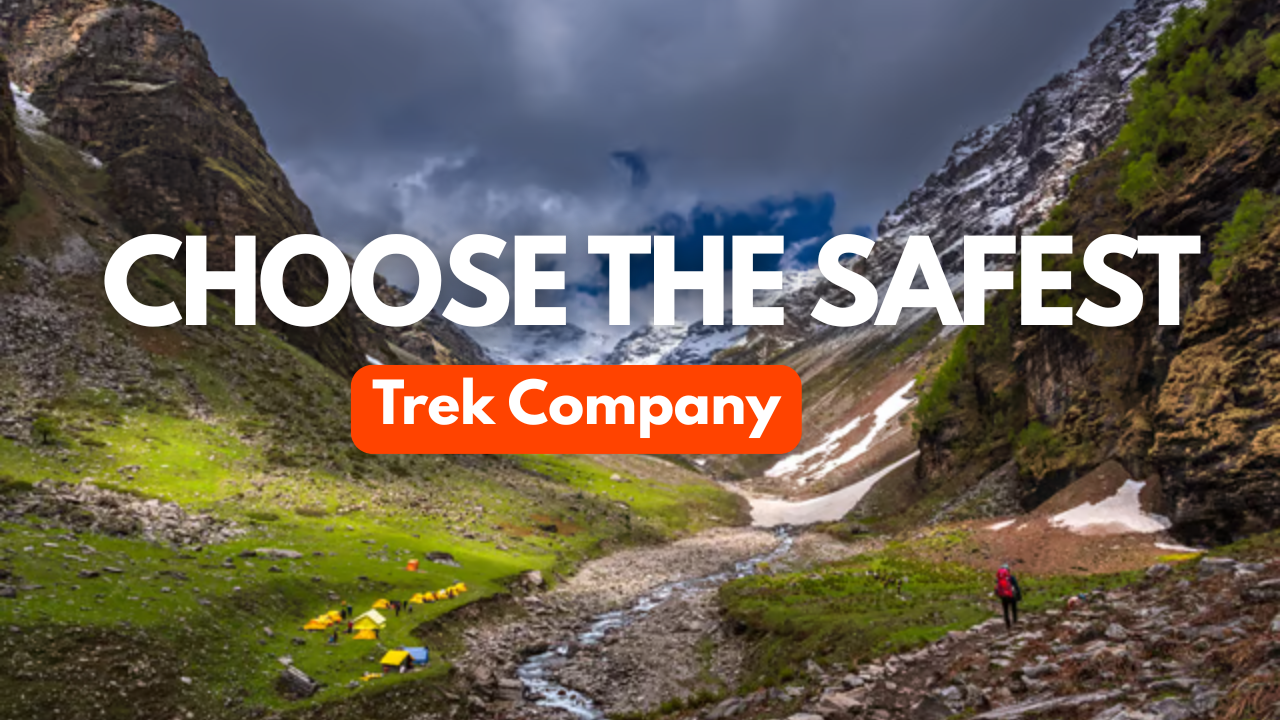
Why Choose Local Experts (Himalayan Hikers)?
The stretch after Gaumukh Glacier is where the real challenge begins. This is not a trek for beginners or unsupervised groups.
- Local Mastery: Being from Uttarkashi, our guides have grown up in these high-altitude terrains. We understand the weather shifts before they happen.
- Safety First: Auden’s Col is famous for its "hidden" dangers. We provide high-quality technical gear and experienced Sherpas who are experts in rope-handling and crevasse rescue.
- Authentic Experience: With us, you don't just trek; you experience the culture and the raw beauty of the Uttarakhand Himalayas through the eyes of the locals.
| Season | Period | What to Expect |
| Pre-Monsoon | 2nd week of May – End of June | Heavy Snow: Ideal for those who love a "true" winter expedition feel. The snow makes the glacier crossing stable but physically demanding. |
| Post-Monsoon | Late August – 2nd week of October | Clarity: The monsoon washes the dust away, offering the sharpest views of the Himalayan giants, though the crevasses are more exposed. |
Why Expertise Matters
Auden’s Col is a "special purpose" trek. Once you move past the Gaumukh Glacier, the terrain transforms. You aren't just walking; you are navigating:
- Technical Crossings: Massive crevasse fields that require rope-up skills.
- Steep Gradients: Vertical climbs that test your cardiovascular limits.
- Local Wisdom: Our Uttarkashi-based team provides the deep logistical knowledge and weather-reading skills that only locals possess.
Warning: Never underestimate the Col. Between the deep snow of June and the technical ice of September, this trek demands respect, elite fitness, and a seasoned guiding team.
Dehradun is the primary assembly point for the Auden's Col. Whether you are coming from Mumbai, Bengaluru, Kolkata, Pune, or Gujarat, you must first reach Delhi or Dehradun.
Option 01: By Train (Best for Overnight Travel)
The most convenient way to reach Dehradun from Delhi is by taking an overnight train. Our team will meet you at the Dehradun Railway Station between 5:45 AM and 6:30 AM.
- Nanda Devi Express (Train No. 12206): Departs New Delhi at 11:30 PM → Arrives Dehradun at 5:45 AM.
- Dehradun Express (Train No. 12687): Departs New Delhi at 9:10 PM → Arrives Dehradun at 5:00 AM.
- Pro Tip: Booking the A/C Special from Hazrat Nizamuddin is the most comfortable option for trekkers.
Option 02: By Air (Fastest Route)
- Airport: Jolly Grant Airport (DED), Dehradun.
- Located 27 km from the city center. Flights are available from all major Indian metros.
- Transfer: Taxis are available at the airport 24/7. A one-way trip to Dehradun city costs approximately ₹800.
Option 03: By Bus
- Source: ISBT Kashmiri Gate, Delhi.
- Service: Frequent Volvo and Deluxe buses run overnight to Dehradun. We recommend booking in advance to ensure a seat.
Himalayan Hikers Transport Service: Dehradun to Gangotri
At Himalayan Hikers, we believe the adventure begins the moment you reach Dehradun. We take full responsibility for arranging your mountain transportation, ensuring a safe, comfortable, and scenic journey to the base camp at Gangotri.
1. Pickup Point & Timing
- Location: Dehradun Railway Station (Main Exit).
- Time: Between 6:00 AM and 7:00 AM.
- Coordination: Our representative or transport coordinator will meet you at the station to guide you to your assigned vehicle.
2. Vehicle Types
Depending on the group size, we provide reliable mountain-tested vehicles:
- Tempo Traveller: For larger groups (10–12 trekkers), offering more space and comfort.
- Ertiga or Innova: For smaller groups (5–6 trekkers), perfect for navigating the sharp Himalayan bends.
3. The Route: A Scenic Mountain Drive
The drive from Dehradun to Gangotri is approximately 258 km and takes about 10 to 11 hours.
- The Path: Dehradun → Mussoorie Bypass → Uttarkashi → Harshil Valley → Gangotri.
- River Views: You will drive alongside the beautiful Bhagirathi River for most of the journey.
- Breakfast & Lunch Stops: We stop at hygienic local dhabas along the way (cost of meals during transport is usually shared or as per package terms).
4. Key Stops Along the Way
- Uttarkashi: A bustling mountain town where we stop for lunch and last-minute trekking supplies.
- Harshil Valley: Known as the "Mini Switzerland of India," this valley is famous for its apple orchards and breathtaking landscapes.

Necessary Items for trekkers
Mandatory Documents
Original and photocopy of government photo identity card- (Aadhar Card, Driving License, Voters ID, etc,)
Passport and Visa important to foreigners
Medical Certificate (First part should be filled by the Doctor and Second part by the Trekker)
Declaration Certificates
Note: – Many trekkers commit the same mistake of carrying unnecessary items on a trek which only makes the backpack heavy. It is important to know the right items to carry. It differs from season to season if you are trekking in summers then carry less layers of warm clothing and if you are trekking in winters carry enough layers to protect yourself against chilly cold.
Basic Trekking Gears

The Clothes You Should Bring On Satopanth Expedition

Head Gears

Foot Gears

Personal Care Essentials

Carry a Personal Medical Kit

Are you Looking for Trekking Equipment on Rent?
If any trekker requires trekking equipment on rent, Himalayan Hikers offers the best-quality gear available for rental. Many individuals are in need of such equipment, and renting provides a cost-effective solution, allowing them to access high-quality gear at an affordable price without the need for a significant investment for short-term use.

Trek Equipment You can book directly on first day at the Base Camp.
Note:-
Please take all medicines only when prescribed by the doctor. In case you face any problem during your trek,
discuss and take advice from the Professional guide.
The Trek is one of the most popular treks in Uttarakhand, Himachal,Kashmir,Laddakh,Sikkim,Nepal, requiring both physical preparation and mental readiness. Although it is categorized as a moderate trek, reaches an elevation of over 12,720 feet and traverses remote Himalayan terrain, which can be physically and mentally challenging. Here's how you can prepare yourself for a safe and successful accomplishment of the Trek:
Physical Fitness
Building a good fitness base is essential for every trekker. The Trek itinerary involves 5 to 6 hours of walking every day. Though the trails are well-marked, they are often bumpy and include steep uphill sections, which may affect your stamina. You can overcome your physical limitation with a 6-week training program that you can begin about 2 months before your Trek. Your 6-week fitness routine should include
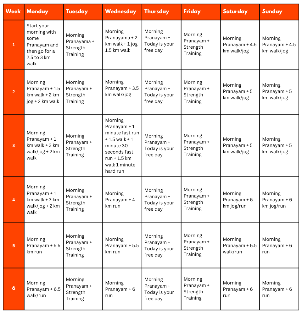
Pro Tip: If you have time, you can skip the Sunday training and go for a long-distance walk or mini day-hike (7–10 km) with a loaded backpack to simulate real trekking conditions. A short 1-day hike around your city/town can help a lot.
Mental Preparation
Physical strength is only half the journey, the other half is mental resilience. The trail takes you through remote clearings, steep climbs, cold starry nights, and no mobile connectivity. Be prepared to:
(I) - Detach from the digital world.
(II) - Embrace basic mountain living (camping, toilet tents, limited electricity).
(III) - Push through moments of fatigue, weather discomfort, or altitude effects.
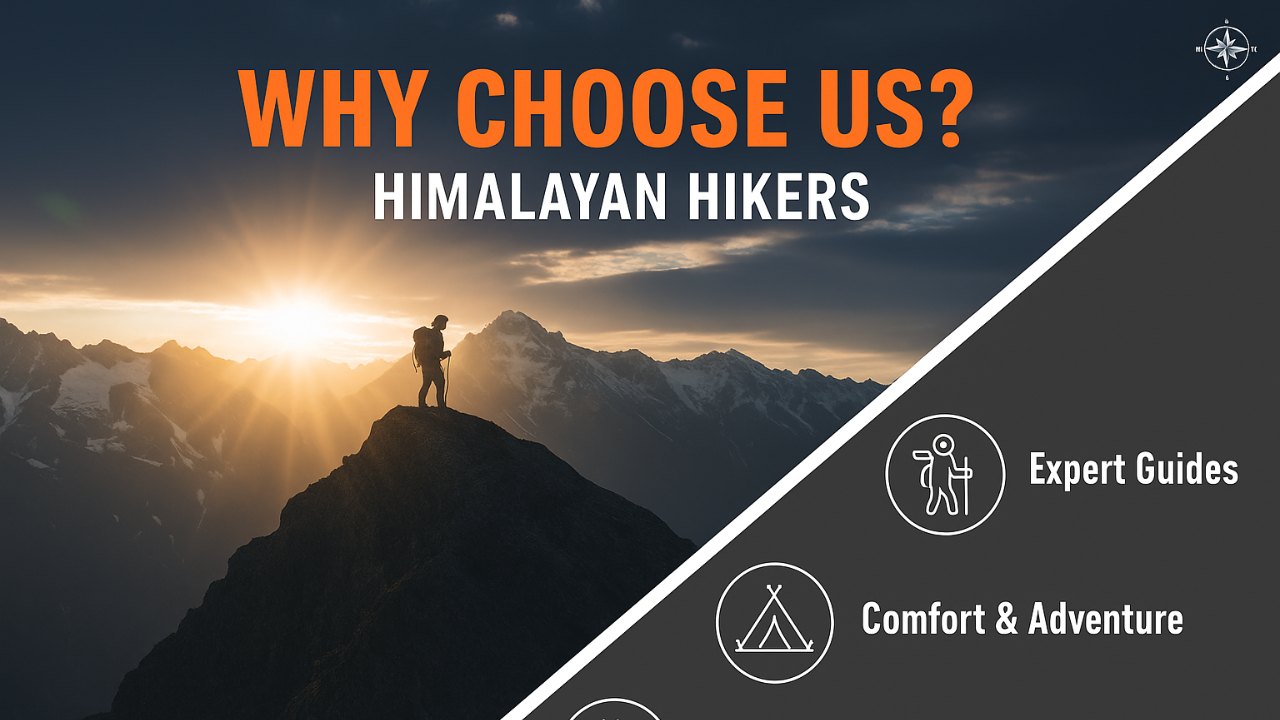
A positive mindset, patience, and the ability to adapt will carry you farther than muscle ever could.Why Choose Himalayan Hikers?
With 28 to 30 years of experience, we aren't just a trekking company; we are a community of mountain lovers.
- The Local Edge: Our staff consists of local experts from the Uttarkashi and Garhwal regions. They don't just know the route; they know the history, the folklore, and the spirit of the land.
- Safety Protocol: We maintain a 1:3 guide-to-trekker ratio for Auden's Col. This ensures personalized attention during the technical sections.
- Eco-Conscious Trekking: We follow "Leave No Trace" principles. We ensure that our presence does not scar the pristine beauty of the glaciers we cross.
- Full Support: From the moment you arrive in Dehradun to the final goodbye at Rishikesh, we handle every permit, meal, and logistical hurdle.
The Cultural Connection: Gangotri to Kedarnath
One of the most profound aspects of this trek is the transition from the Bhagirathi (Ganga) to the Mandakini river systems.
- Gangotri: The seat of Goddess Ganga, where the journey begins with blessings and bells.
- Kedarnath: The seat of Lord Shiva. After days of battling ice and rock, arriving at the Kedarnath temple feels like a homecoming. It adds a layer of spiritual fulfillment to the physical triumph of the trek.
What is Included In This Trek?
- Transport Facility Dehradun To Dehradun
- Forest Permit and entrance fee
- Accommodation in tents on twin share basis
- All meals: breakfast, packed lunch, tea, coffee, snacks, soup and dinner
- (All camping gears)
- High quality tents
- Sleeping bags
- Mattress
- Liner
- Pillow
- Separate Toilet tents – Ladies and Gents
- Dining Tent
- Dining Table
- Porters
- Helper
- Mules
- Kitchen team
- Radio Walkie Talkie for Communication
- Good Experience Trek Leader guide and Technical guide
- Medical Kit
- Oxygen Cylinders
- Crampons and Gaiters
What is Not Include In This Trek?
- Personal Insurance
- Medical Certificate
- Personal toiletry Items and Personal Medicine kit
- On first day En Route to base camp the Breakfast and Lunch are Not Included
- Last Day En Route Lunch and Dinner are Not Included
Important Note
No important note.
Map of Auden's Col Trek Route
Map not available for this trek.
No FAQs available for this trek.