Announcement: Fixed departure groups for


Every now and then, there’s a clearing where sunlight breaks through, and the quiet is interrupted only by the wind or the distant call of a bird. The trail doesn’t feel curated. It feels like it’s just been there, waiting for you.
The trek rises gently to about 7,460 feet, nothing extreme, but enough to give you those crisp Himalayan views if the weather’s in your favor. As you move higher, the trees thin out and the sky opens. You might catch a glimpse of Bandarpoonch and Yamuna Valley far below, shining in the sun.
Benog Tibba hill trek is one of those treks where you can be with yourself. There’s no crowd, no shops, and no race towards the summit. This 4-5 hour easy trail gives you ample time to enjoy the songs of nature, you can see rare mountain birds like Wall creeper, Tree creeper, Nightjar, etc, and constant mating calls of the Yellow Kempfer cicada create a scene similar to Japanese anime.
This is one of those famous forest treks in Uttarakhand with no crowd, shops, or drama. That’s exactly why it’s special. It’s ideal if you’re in or near Mussoorie and want a few hours in nature that actually feel like nature, not a theme park. You don’t need specialized trekking gear; all you need is a well-informed local guide, a permit, and water to keep you hydrated throughout the trek.
By the time you reach the top, you will spot a Jwala Mata temple mounted on the top of the Benog Tibba summit. The views of Yamuna valley and the distant peaks of the Great Himalaya are breathtaking. Here you can spot some prominent Himalayan peaks like Kalanag, Swargarohini, Bhrigupanth, Gangotri I, II, III, Bandarpoonch, etc.
Benog Tibba isn’t about reaching a summit. It’s about walking slowly through a forest that still feels wild and letting your thoughts wander a bit.
Benog Tibba Trek Highlights
If you’re looking for an offbeat trekking experience near Mussoorie, the Benog Tibba trek offers the perfect mix of nature, tranquility, and Himalayan beauty. Here’s what makes this hidden gem worth exploring:
1. A Peaceful Forest Trail Away from the Tourist Rush
Starting from Cloud’s End, one of the most serene spots in Mussoorie, the trail to Benog Tibba winds through a lush forest, offering a quiet escape from the usual tourist bustle. You’ll walk under a canopy of oak, pine, and rhododendron trees, soaking in the sounds and scents of the Himalayas.
2. Explore the Benog Wildlife Sanctuary
The route passes through the pristine Benog Wildlife Sanctuary, a haven for nature lovers and birdwatchers. Keep your eyes open for rare Himalayan birds like the red-billed blue magpie. While the Himalayan Quail is believed to be extinct, the area still holds ecological importance with its untouched biodiversity.
3. Stunning Views of the Garhwal Himalayas
Reach the summit, and you’ll be greeted with sweeping views of the Garhwal Himalayan range. On a clear day, majestic peaks like Bandarpoonch and Chaukhamba shimmer in the distance, making it a perfect spot for photography or a quiet moment to take it all in.
4. Jawala Devi Temple Along the Way
On your way up, you’ll come across a peaceful shrine dedicated to Goddess Jawala Devi, located at the top of the Benog hill. This small temple adds a spiritual touch to the journey and is a cherished stop for both locals and pilgrims.
5. Ideal for Beginners and Families
The Benog Tibba trek is short, well-marked, and doesn’t demand any advanced trekking gear, making it great for beginners, families, and weekend adventurers. It’s a fantastic introduction to Himalayan trekking without the need for a long itinerary.
6. Perfect for a Weekend trek from Dehradun
Just a 2-hour drive from Dehradun, this trek can easily fit into a weekend plan. Whether you’re a solo traveler or coming with friends, it’s a refreshing nature retreat that’s big on experience but light on time.
Benog Tibba Trek Complete Guide
Our mission has always been to ensure that no trekker steps into the Himalayas without the right perspective. A trek is not just a checklist of summits; it is a serious commitment to the outdoors. Having the right information is what separates a reckless climb from a soulful journey.
This section serves as your definitive manual for the Benog Tibba Trek. We have distilled years of mountain experience and real-time feedback into this guide to give you a clear, honest picture of the trail.
We provide this depth of information because we want you to be more than just a visitor—we want you to be a prepared, responsible trekker who respects the mountains as much as we do
Day 1 – Drive to Mussoorie Clouds End Forest Resort from Dehradun and start trekking
Drive Distance:39.6 km |Trek Distance:8.5 km |Trek Duration:7 to 8 hours |Trek Difficulty: Easy |Trek Altitude:7,460 to 5150 ft
Day 2 – Benog Tibba Camp Site to Drive Back To Dehradun
Trek Duration:2 hours |Trek Distance: 300 m | Drive Distance:39.6 km | Trek Difficulty: Easy
Day 1
Day 2
Day 1 – Drive to Mussoorie Clouds End Forest Resort from Dehradun and start trekking
- Benog Tibba Trek Route: Dehradun → Mussoorie → Cloud’s End → Benog Wildlife Sanctuary → Benog Tibba Summit → Return
- Trek Duration: 4–5 hours (round trip)
- Distance Covered: Approx. 8.5 km
- Altitude: 2,000 m to 2,250 m
The journey starts from Dehradun Railway Station, where trekkers are expected to arrive by 7:00 AM. After assembling at the pickup point, you’ll begin the drive towards Mussoorie. The route takes you through Rajpur and Malsi, gradually climbing past the historic Mussoorie Mall Road and onward toward Library Chowk. Eventually, you’ll reach Cloud’s End, a peaceful corner of Mussoorie and the starting point of the Benog Tibba trek.
If you’re already in Mussoorie, you can join the group at our secondary pickup point, Library Chowk, at 8:15 AM. This flexible option makes it convenient for both outstation travelers and local explorers to kickstart their Benog Tibba trek journey.
The actual trek begins from Cloud’s End, through dense Himalayan forest. The trail is natural yet easy to follow, winding through oak, pine, and rhododendron trees. This area falls within theBenog Wildlife Sanctuary, a protected region known for its biodiversity. It was once home to theHimalayan Quail (Ophrysia superciliosa), a bird now considered extinct. Keep an eye out for red-billed blue magpies and other native species as you make your way uphill.
There are no water sources along the trail, so it’s important to carry enough before starting. About halfway through, a forest clearing offers a scenic rest point with partial views of George Everest Peak and distant Himalayan ridgelines.
As you continue, a small temple dedicated to Jwala Devi appears near the summit. Locals often visit this sacred spot to offer prayers, and you may hear temple bells carried by the wind through the trees.
By late morning, you’ll reach the Benog Tibba summit. The views are extensive on clear days, you can see Bandarpoonch, Chaukhamba, and parts of the Garhwal Himalayas. After spending quality time at the Benog Tibba summit, begin your descent to the Benog campsite via the same trail, where you can enjoy a peaceful night in the serene forest of Benog Wildlife Sanctuary.
Day 2 – Benog Tibba CampSite to Drive Back To Dehradun
- Trek Duration: ~2 hours
- Trek Distance: Approx. 300 m
- Drive Distance: about 39.6 km
- Trek Difficulty: Easy
Your second day on the Benog Tibba Trek begins with the stillness of early morning in the forest. After a warm cup of tea and a simple breakfast at the Benog Tibba campsite, you’ll begin the short descent back towards Cloud’s End, retracing your steps through the serene oak and pine-lined trail. It’s a relaxed walk that allows time to take in the sounds and scenery of the Benog Wildlife Sanctuary one last time. Keep your camera handy because early mornings often bring out birdlife, and the trail looks especially picturesque with soft morning light filtering through the trees.
Once you arrive at the Benog Tibba base camp, your transport will be ready to begin the return journey to the drop location. The drive back covers roughly 39.6 kilometers, taking you through the winding hills of Mussoorie, past the familiar towns and valleys you saw the day before.
The Benog Tibba trek difficulty is considered an easy trek, making it suitable for beginners, families, and casual trekkers. Unlike high-altitude Himalayan treks likeKedarkantha,Har Ki Dun,Sar Passtreks, this trail is more relaxed in pace and altitude, but still offers a rewarding experience with stunning views and forest immersion.
Trek Gradient and Terrain
The trail involves a gradual ascent, with no steep climbs or technical sections. Starting near Cloud’s End, the route follows a well-trodden forest path through the Benog Wildlife Sanctuary, with only a mild elevation gain, from around 2,000 meters to 2,250 meters. Almost 70% of the trail is shaded with Rhododendrons, Deodar, Box Myrtle (Kaphal), and soft underfoot, covered in forest soil, Banj Oak leaves, and occasional rocky patches.
Altitude and Acclimatization
Since Benog Tibba’s highest point is only 2,250 meters, there is no risk of altitude sickness. The air is cool and fresh, but oxygen levels remain normal, so no special acclimatization is required.
Support and Accessibility
The trek starts close to Mussoorie, with easy road access, no permit requirements, and no technical gear needed. Trekkers are advised to carry water, comfortable walking shoes, and light layers.
Note:-If you are trekking without an organized group or local guide, then you will need to pay entry fee of 150₹ at the Benog Wildlife Sanctuary Checkpost.
Wondering when to plan your trek to Benog Tibba?
While the trail remains accessible for most of the year, certain seasons bring out the best of the forest, views, and overall experience.
Spring (March to June): Fresh, Vibrant, and Inviting
This is one of the most popular seasons for trekking in the region. The forests come alive with blooming rhododendrons, including tiny white, pink, and yellow wildflowers. The weather stays comfortably cool, clear skies offer excellent visibility of the distant Himalayan peaks, and rare bird species make it heaven for birdwatchers and photographers. If you’re after lush greenery and pleasant temperatures, this is your window.
Autumn (September to November): Crystal Clear and Quiet
Autumn is the best time to visit the Benog Tibba trek. It’s a perfect time to experience the post-monsoon freshness in the air and the panoramic views become even sharper. The trail is dry, the skies are deep blue, and the air feels crisp. It’s a fantastic time for those looking to avoid crowds while still getting the best visuals.
Monsoon (July to August): Best Avoided
The trail tends to get muddy and slippery during the monsoon months. Leeches and unpredictable rains can make the hike uncomfortable, and the risk of landslides increases in the surrounding region. It’s best to skip this season unless you’re experienced and prepared for wet conditions.
Winter (December to February): Snowy and Serene
For trekkers who enjoy the cold and don’t mind a bit of a challenge,Benog Tibba in winter can be magical. Snow sometimes blankets the summit, turning the trail into a quiet, white wonderland. The hike becomes a bit more demanding, especially near the top, but the solitude and scenic beauty are absolutely worth it.
Getting to the Benog Tibba trek is fairly straightforward, especially if you’re starting from Mussoorie or Dehradun. Here’s a simple breakdown to help you plan your trip.
From Dehradun
Dehradun is the nearest major city with excellent road, rail, and air connectivity. If you’re flying in, Jolly Grant Airport is your landing point. From there, it’s about a 2 to 3-hour drive to Mussoorie via a scenic hill road. Taxis and buses are easily available at the airport and the railway station.
Reaching Cloud’s End (Starting Point)
The actual trek begins from Cloud’s End, a quiet spot located roughly 6–7 km from Mussoorie town. It’s accessible by local taxi or private car. The road up to Cloud’s End is narrow but drivable, passing through peaceful forest-covered stretches. This area also has a few heritage sites if you want to spend the night before starting your trek.
Once you arrive at Cloud’s End, the forest trail to Benog Tibba starts near the gate of the Benog Wildlife Sanctuary. From here, it’s a gradual hike through thick woodland, perfect for nature lovers and those looking to escape the noise of city life.
Alternative Access
If you’re already in Mussoorie, hiring a local cab or even biking to Cloud’s End is a fun option. The route is short, but it offers stunning views along the way, especially around sunrise or sunset.
ATM & Network Connectivity
When heading towardBenog Tibba, it’s best to be prepared in advance, as the area gets quite remote once you leave Mussoorie.
ATMs Availability
The last reliable place to withdraw cash isMussoorie town. You’ll find several ATMs from major banks like SBI, PNB, ICICI, and HDFC along Mussoorie Mall Road and in Landour. Once you move toward Cloud’s End or the trekking route, there areno ATMs, so make sure to carry enough cash for transportation, snacks, or any last-minute purchases.
Mobile Network
Mobile connectivity can be spotty aroundCloud’s Endand completely unreliable deeper into the forest trail. WhileAirtel and Jio usually have decent coverage in Mussoorie, you might lose signal shortly after starting the trek. If you need to make calls or check maps, it’s a good idea to do it before reaching the sanctuary gate.
Pro Tip:Download offline maps and share your location with someone before heading into the forest zone.

Necessary Items for trekkers
Mandatory Documents
Original and photocopy of government photo identity card- (Aadhar Card, Driving License, Voters ID, etc,)
Passport and Visa important to foreigners
Medical Certificate (First part should be filled by the Doctor and Second part by the Trekker)
Declaration Certificates
Note: – Many trekkers commit the same mistake of carrying unnecessary items on a trek which only makes the backpack heavy. It is important to know the right items to carry. It differs from season to season if you are trekking in summers then carry less layers of warm clothing and if you are trekking in winters carry enough layers to protect yourself against chilly cold.
Basic Trekking Gears

The Clothes You Should Bring On Satopanth Expedition

Head Gears

Foot Gears

Personal Care Essentials

Carry a Personal Medical Kit

Are you Looking for Trekking Equipment on Rent?
If any trekker requires trekking equipment on rent, Himalayan Hikers offers the best-quality gear available for rental. Many individuals are in need of such equipment, and renting provides a cost-effective solution, allowing them to access high-quality gear at an affordable price without the need for a significant investment for short-term use.

Trek Equipment You can book directly on first day at the Base Camp.
Note:-
Please take all medicines only when prescribed by the doctor. In case you face any problem during your trek,
discuss and take advice from the Professional guide.
The Trek is one of the most popular treks in Uttarakhand, Himachal,Kashmir,Laddakh,Sikkim,Nepal, requiring both physical preparation and mental readiness. Although it is categorized as a moderate trek, reaches an elevation of over 12,720 feet and traverses remote Himalayan terrain, which can be physically and mentally challenging. Here's how you can prepare yourself for a safe and successful accomplishment of the Trek:
Physical Fitness
Building a good fitness base is essential for every trekker. The Trek itinerary involves 5 to 6 hours of walking every day. Though the trails are well-marked, they are often bumpy and include steep uphill sections, which may affect your stamina. You can overcome your physical limitation with a 6-week training program that you can begin about 2 months before your Trek. Your 6-week fitness routine should include

Pro Tip: If you have time, you can skip the Sunday training and go for a long-distance walk or mini day-hike (7–10 km) with a loaded backpack to simulate real trekking conditions. A short 1-day hike around your city/town can help a lot.
Mental Preparation
Physical strength is only half the journey, the other half is mental resilience. The trail takes you through remote clearings, steep climbs, cold starry nights, and no mobile connectivity. Be prepared to:
(I) - Detach from the digital world.
(II) - Embrace basic mountain living (camping, toilet tents, limited electricity).
(III) - Push through moments of fatigue, weather discomfort, or altitude effects.
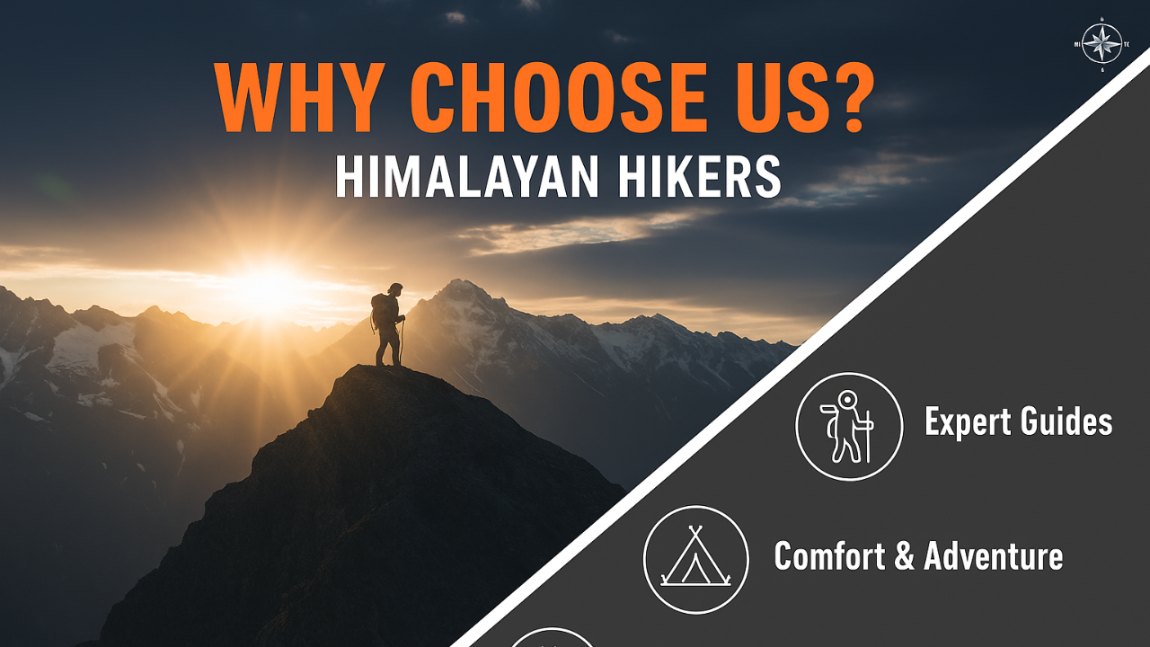
A positive mindset, patience, and the ability to adapt will carry you farther than muscle ever could.Himalayan Hikers is a reputable trekking company that places a high priority on safety. Here are some of the safety measures they take to ensure the safety of their clients during the Trek:
Experienced Guides: Himalayan Hikers hires experienced and certified guides who are well-versed in the terrain, weather conditions, and local culture. These guides have first-hand knowledge of the routes and are equipped to handle any emergency situations that may arise.
Proper Gear: The company provides all the necessary gear and equipment to their clients to ensure comfort and safety during the trek.
Hygiene and Sanitation: Himalayan Hikers places great emphasis on hygiene and sanitation during the Trek. They provide clean drinking water, hand sanitizers, and toilet tents to ensure that their clients are healthy and comfortable.
Emergency Services: The company has a well-defined protocol for handling emergency situations. They have a team of trained medical professionals who are available 24/7 and can be quickly mobilized in case of an emergency.
Acclimatization: Himalayan Hikers follows a gradual acclimatization process during treks to ensure that their clients adjust to the high altitude gradually. They also monitor the health of their clients regularly and provide necessary medical attention if required.
Overall, Himalayan Hikers places a great emphasis on safety and takes all necessary measures to ensure the safety and well-being of their clients during treks.
What Is Included In This Trek?
- Transport from Dehradun to Dehradun – Tempo Traveller or Taxi
- Forest Permit and entrance fee
- Experienced Trek Leader, Local guide
- Accommodation in tents on a twin/three-share basis
- Sleeping bags, Mattress, Liner
- All meals: Breakfast, Lunch, Tea, Coffee, Snacks, Soup and Dinner
- Dining Tent, Dining Table, Helper, Kitchen team
- Separate Bio Toilet tents – Ladies and Gents
- Radio Walkie-Talkie for Communication
- Medical Kit
What is Not Included In This Trek?
- Personal Insurance
- Medical Certificate if you Age 50 and above
- Personal toiletry Items and Personal Medicine kit
- On the first day, En Route to base camp Breakfast and Lunch are Not Included
- Last day, En Route Lunch and Dinner are Not Included
Important Note
Himalayan Hikers – Provided Food During The Benog Tibba Trek
We serve 5 meals daily, including Breakfast, Lunch, Evening Snacks, Soup, and Dinner. A variety of delicious and healthy food is provided, which includes Indian, Chinese and other Western meals. They are nutritious and keep you fit and healthy on the trek. (Veg or non-veg food) With our local food and Day Pack.
Our Food Menu: We have nutritious Veg and Non-Veg Menus
Veg: Roti + Rice + Salad + Papad + Matter Paneer + Daal + Mix Veg + Fresh Vegetable + Sweets + Bread + Omelets + Nutella + Jam + Butter + Muesli + Milk + Banana + Aloo paratha + Tea & Coffee Cornflakes.
Non-Veg: Milk + Egg Bhurji + Bread, Peanut Butter + Pancake + Plain Paratha +Fruits Porridge Oats + Bread & Cheese + Poha + Boiled Egg + Gulab Jamun + Custard + Jalebi + Chilla +Honey+ Puri + Chole and more.
Note:- This is only a list of the Himalayan Hikers Team or Cook to provide you with more healthy food and more items per day menu.
Nutritional Food For Our Trekkers
Also, the type of food provided during a trek can vary depending on factors like the location, duration, and the trekking company or organization you’re with. However, some common types of food are often included in trekking provisions:
Carbohydrates: Foods high in Carbohydrates provide energy for the trek. This includes items like rice, pasta, bread, potatoes, etc.
Proteins: Protein-rich foods help with muscle repair and recovery. Common protein sources include lentils, beans, tofu, meat (if available), eggs, and dairy products.
Fruits and Vegetables: These provide essential vitamins, minerals, and fiber. While fresh produce may not always be available, dried fruits and vegetables or canned options might be included.
Snacks: Trekking often involves long hours of physical exertion, so snacks are important for quick energy boosts. Snacks like nuts, energy bars, trail mix, and chocolate are common choices to boost your energy level.
Local Cuisine: Depending on the region you’re trekking in, you might also get the chance to sample traditional dishes. This can be a delightful way to experience the culture and flavors of the area.
Yes, the Benog Tibba trek can be completed in a single day. It’s a short and beginner-friendly trek, making it ideal for a day trip from Mussoorie. Start early to enjoy the views and return by evening.
The trek begins from Cloud’s End, a peaceful area located around 6–7 kilometers from Mussoorie Library Chowk. It’s the entry point to the Benog Wildlife Sanctuary, where the trail leads into dense forest and eventually up to the summit.
The total trek is approximately 8-9 kilometers, depending on the route taken. Most trekkers complete it in 4 to 5 hours, including breaks. It’s a relatively easy trail suitable for all fitness levels.
Benog Tibba is known for its offbeat forest trail, scenic views of the Garhwal Himalayas, and rich biodiversity within the Benog Wildlife Sanctuary. The peaceful surroundings and panoramic summit views make it a hidden gem near Mussoorie.
The spring (March–June) and autumn (September–November) seasons are the best times for the Benog Tibba trek. These seasons offer clear skies, mild weather, and vibrant landscapes. Avoid monsoon months due to slippery trails and winter if you’re not comfortable with snow.