Satopanth Tal Trek

8 Days - 7 Nights Dehradun to Dehradun
  • Satopanth-lake
  • Satopanth-lake-1
  • Satopanth-lake-4
  • Satopanth-lake-7
  • Satopanth-lake-8
  • Satopanth-lake-9
  • Satopanth-lake-10

Description

The Satopanth Tal trek is a popular trekking route in the Indian state of Uttarakhand. It leads to a glacial lake called Satopanth Tal Uttarakhand Himalayas

The Satopanth Tal trek is a captivating journey through the majestic Himalayan landscapes of Uttarakhand, India. Here’s an overview of what you can expect:

  1. Location: Situated in the Chamoli district of Uttarakhand, the trek starts from Mana village, which is near the famous pilgrimage site of Badrinath.
  2. Duration: The trek typically takes around 6-8 days to complete, depending on the route and pace chosen by trekkers.
  3. Altitude: The trek reaches a maximum altitude of approximately 4,600 meters (15,092 feet) at Satopanth Tal, which is a glacial lake surrounded by towering peaks.
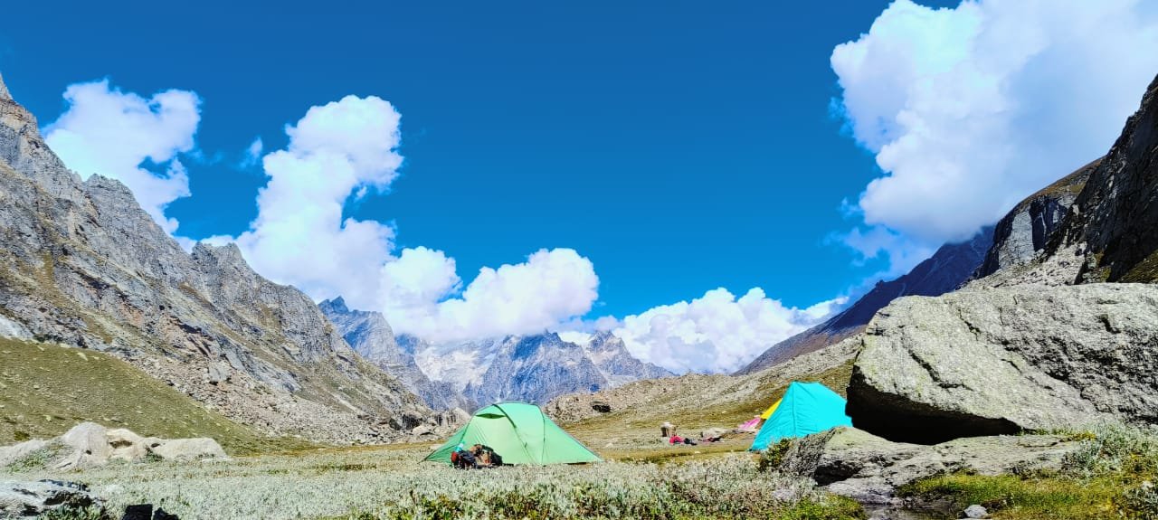
  4. Terrain: The trail winds through diverse terrain, including dense forests, rocky paths, alpine meadows, and glacial moraines. Trekkers encounter steep ascents and descents, as well as river crossings along the way.
  5. Highlights:
    • Mana Village: Starting point of the trek and the last inhabited village on the India-China border.
    • Vasundhara Falls: A stunning waterfall along the route, believed to be associated with Hindu mythology.
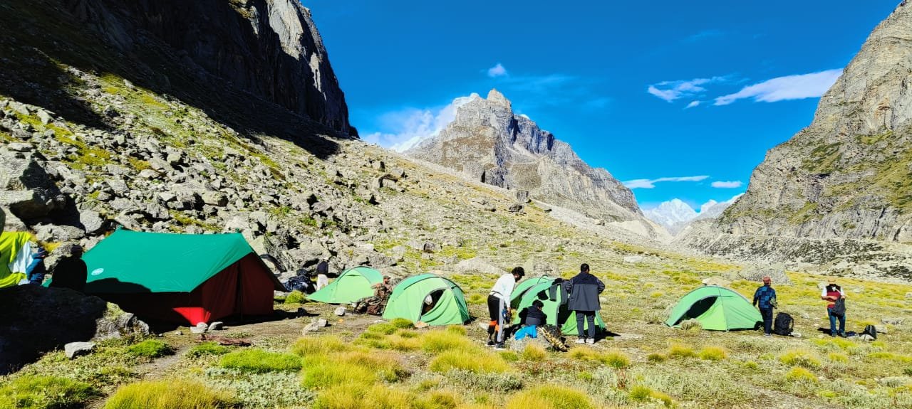
    • Chakratirtha: A picturesque campsite offering panoramic views of surrounding peaks.
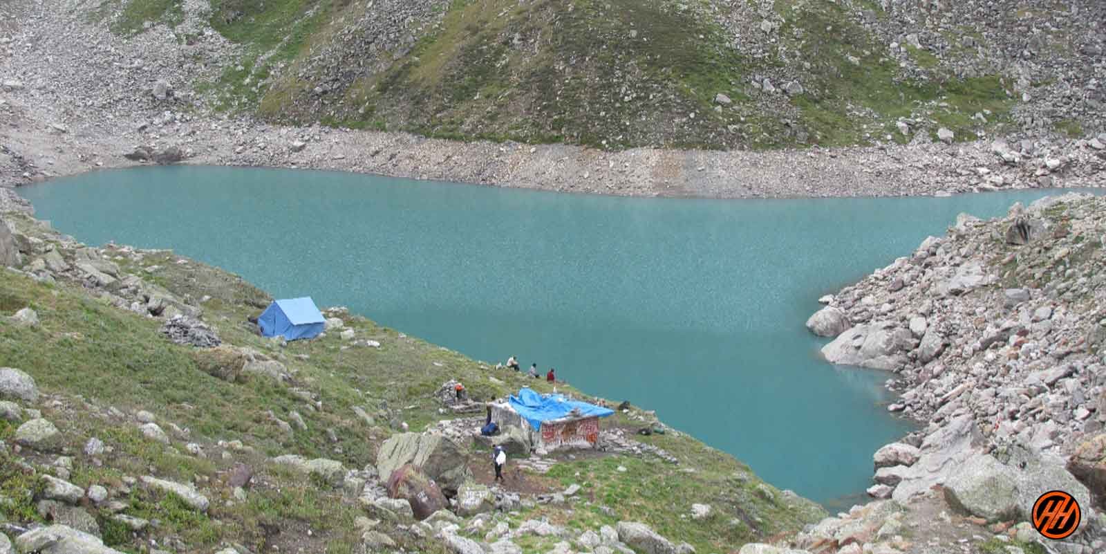
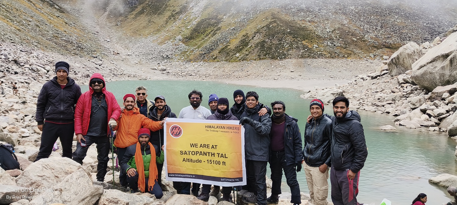
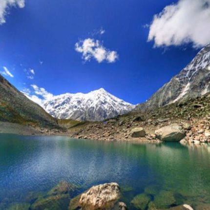
    • Satopanth Tal: The ultimate destination, a pristine glacial lake surrounded by snow-clad peaks. It is considered sacred by Hindus and holds mythological significance.
  6. Challenges: The trek presents various challenges, including high altitude, unpredictable weather, and rugged terrain. Proper acclimatization, physical fitness, and adequate preparation are essential for a successful journey.
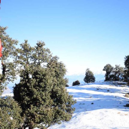
  7. Best Time to Visit: The trek is usually undertaken from May to October, during the summer and autumn months, when the weather is relatively stable and the trail is accessible. However, conditions can vary, so it’s essential to check weather forecasts and trail conditions before planning the trek.

Overall, the Satopanth Tal trek offers a memorable adventure amidst the pristine beauty of the Himalayas, attracting trekkers seeking both physical challenge and spiritual rejuvenation.

Wishes here never go unfulfilled in Satopanth Tal

Satopanth Tal is a High Altitude Lake at a height of 4,600 Meter. It is one of the virgin treks not known by many but the trekker and sadhu sant or local people of the area believe that this lake is sacred and possess some supernatural power of fulfilling wishes.

The Satopanth Tal is between two beguiling the trail is thrilling through dense forest, meadows with enchanted beauty and some steep ridges but the panorama views from the top cannot be described in words.

Trek to this sacred Tal is a difficult one but as the beliefs of people wishes are fulfilled here so it’s worth going there, this part of swargarohini the way to Heaven.

Satopanth-lake

Story of Satopanth Tal Trek

It is believed that Lord Brahma, Vishnu and Mahesh often took bath in the waters of Satopanth Tal since then it is considered sacred and pure. Devotees believe that a holy dip in Satopanth Tal will wash away so every year thousands of people visit this place.

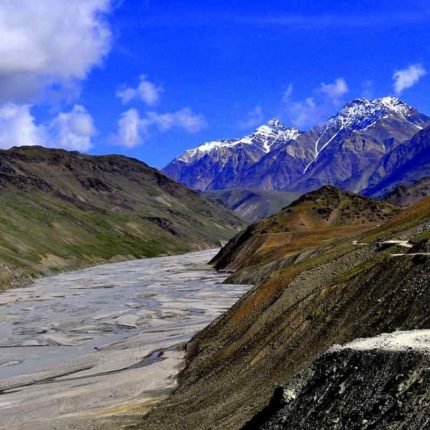
To reach this Lake, trek through some Himalayan villages, wide meadows with several streams en route and go through glaciated tracks. It is going to be an adventurous journey.

Mountain views, the great snow-capped peaks visible are Nilkanth, Swargarohini, Narayan Parbat and Balakun with some thrilling views of Chaukhamba Peaks.

Best Time to Visit Satopanth Tal  Trek ?

Satopanth Tal trek  is a very beautiful  and an Moderate  trek in the Uttarakhand Himalaya The Satopanth Tal trek  is great for those people who have a great passion for mountaineering and consider it a special purpose in their life. Satopanth Tal trek  is such a trek where you get to see more than one Himalayan mountain range..

You can do Satopanth Tal trek  May, June, July, September, October, For those who like summer treks, they can go summer treks are a very good time for those who want to see snow Glacier Greenery .

Satopanth Tal trek  is also a good trek for Monsoon trek at that time there are flowers and green greenery which makes the trek very memorable.

The Satopanth Tal trek  starts from Mana Village near Badrinath in Uttarakhand, state India which comes in Gharwal Mountain  Range  District Chamoli

During the day the temperature of Satopanth Tal trek  is around ( 08°C to 18 °C  and during the night the temperature comes down to  05 °C  to 08 °C  which is not bad.

You will never consider yourself boring in Satopanth Tal trek  , this trek can give you nothing but joy, You will get to see the Garhwali and Bhotiya, Traditional culture in mana village this trek which will always keep you connected towards the mountain. Himalayas.

Satopanth-lake

Badrinth Dham Base Camp of Satopanth Tal Swargarohini

The base camp for the Satopanth Tal trek is typically set up in or around the town of Badrinath, which serves as the starting point for the trek. Here’s an overview of Badrinath and its significance as the base camp:

  1. Location: Badrinath is a town located in the Chamoli district of Uttarakhand, India. Situated at an elevation of approximately 3,100 meters (10,170 feet) above sea level, it is one of the Char Dham pilgrimage sites and is revered by Hindus.
  2. Accessibility: Badrinath is well-connected by road to major cities like Dehradun, Rishikesh, and Haridwar. The nearest airport is the Jolly Grant Airport in Dehradun, and the nearest railway station is in Haridwar.
  3. Pilgrimage Site: Badrinath is famous for the Badrinath Temple, dedicated to Lord Vishnu. It is one of the holiest shrines in Hinduism and attracts thousands of devotees and tourists every year, especially during the pilgrimage season.
  4. Base Camp Facilities: As the base camp for the Satopanth Tal trek, Badrinath offers various facilities and amenities for trekkers, including accommodation options ranging from budget guesthouses to more comfortable hotels. Trekkers can also find restaurants, shops, and equipment rental services in the town.
  5. Acclimatization: Since Badrinath is situated at a relatively high altitude, it serves as an ideal location for trekkers to acclimatize before starting the trek to higher elevations. It’s essential for trekkers to spend a day or two in Badrinath to adjust to the altitude and prepare for the journey ahead.
  6. Starting Point: From Badrinath, trekkers begin their journey towards Satopanth Tal, following a well-defined trail that passes through scenic landscapes, including forests, meadows, and rocky terrain.

 Difficulty level is  Satopanth Tal trek ?

The Satopanth Tal trek is considered to be of moderate to challenging difficulty. Here’s why:

  1. High Altitude: The trek reaches altitudes above 4,000 meters (13,000 feet), with the highest point being around 4,600 meters (15,092 feet) at Satopanth Tal. Altitude-related challenges such as altitude sickness can affect trekkers, so proper acclimatization is crucial.
  2. Terrain: The trek involves a variety of terrain, including rocky paths, steep ascents and descents, glacial moraines, and possibly snow-covered sections, especially early in the trekking season. Trekking poles and sturdy footwear are recommended to navigate the terrain.
  3. Weather: Weather conditions in the Himalayas can be unpredictable, with the possibility of sudden changes, including rain, snow, and high winds. Trekkers should be prepared for varying weather conditions and dress accordingly with layers.
  4. Duration and Distance: The trek typically takes 6-8 days to complete, covering a distance of approximately 60-70 kilometers (37-43 miles) round trip. Daily hiking distances can vary, with some days involving longer stretches and more challenging terrain.
  5. Physical Fitness: While prior trekking experience isn’t always necessary, a good level of physical fitness is recommended to undertake the Satopanth Tal trek. Regular cardiovascular and strength training exercises can help prepare for the demands of the trek.
  6. Remote Location: The trek takes place in a remote and relatively isolated region of the Himalayas. Facilities such as accommodation and medical assistance may be limited along the route, so trekkers should be self-sufficient and prepared to deal with emergencie

 Satopanth Tal trek  trek safe for Beginner ?

Yes Satopanth Tal trek  is a safe trek if you are going with a good trekking team which you must know before booking yourself, It is important for you to know that the bow trekking organization with which we are going is right or not, The minimum age required to trek Satopanth Tal trek  is 12 years and maximum 60 years. The rest depends on your fitness .

  1. High Altitude: The trek reaches altitudes above 4,000 meters (13,000 feet), which can pose risks of altitude sickness for inexperienced trekkers. Beginners may not be accustomed to the effects of high altitude on their bodies, making them more susceptible to altitude-related illnesses.
  2. Physical Demands: The trek involves long hours of walking each day, covering rugged terrain with steep ascents and descents. Beginners may not have the necessary physical fitness or stamina to handle the demands of the trek, leading to exhaustion or injury.
  3. Limited Facilities: The trek takes place in a remote and relatively isolated region of the Himalayas, where facilities such as accommodation, medical assistance, and rescue services may be limited. Beginners may not have the experience or resources to deal with emergencies that may arise during the trek.
  4. Weather Conditions: Weather conditions in the Himalayas can be unpredictable, with the possibility of rain, snow, and high winds. Beginners may not have the knowledge or equipment to deal with adverse weather conditions, increasing the risks associated with the trek.
  5. Experience: The Satopanth Tal trek requires some level of prior trekking experience to navigate the terrain, manage altitude-related challenges, and ensure safety throughout the journey. Beginners may benefit from starting with shorter and less challenging treks to build up their skills and confidence before attempting more difficult treks like Satopanth T

What should you keep in mind for the Satopanth Tal trek?

Satopanth Tal trek  trek is as good as it is said, you also need to be prepared., Satopanth Tal is a   moderate trek which starts from Mana Village  and ends after trek  Mana Village

So what are the special things to keep in mind before coming on this trek?

Satopanth Tal trek  is one such trek, which you can do this  trek Summer, or Monsoon, this is very safe trek in Uttarakhand Himalayas.

Satopanth-lake

Summer Season

  1. Summer trek to Satopanth Tal is very special, the view and the temperature are all favorable to you
  2. For summer trek, you have to bring only normal clothes, so that your trek can be good, there is no need for hot clothes, but in hiking it is also necessary to bring all the equipment which is necessary for you.
  3. It is necessary to have 3 pairs of clothes from trekking, especially the poncho, you will have to bring every season
  4. In the summer season, the temperature is always normal, so there is no need for hot clothes.

 Monsoon Season

  1. During the monsoon season, it rains occasionally during the Satopanth Tal trek especially in the Uttarakhand Himalayas , so if you have dry clothes here, it is very good, even when wet, it dries quickly.
  2. At this time you have to bring at least 3 pairs of clothes, for monsoon trek you do not have to bring too warm clothes, at this time you, hiking pants and t-Sart, I can trek
  3. It’s only a little cold in the morning and evening and the day is a good temperature for you
  4. Before going on any trek, it will be easy for you to take information related to each season.
  5. Trekkers need to know about these, you can ask us anytime like, Satopanth Tal trek route, trek map, temperature, weather condition, difficulty level, trek starting point, end point, transport, view of the trek, best time to visit, How to reach Satopanth Tal distance etc, Trek Location, keep this information before going
  6. 5. You also find some types of flowers in Satopanth Tal which are very beautiful, these treks are very safe trek for monsoon.

Brief Details of Satopanth Tal?

Before heading towards the itinerary, it is really essential to perceive the reason behind choosing Satopanth Tal trek.

See firstly, the trekking distance is a total of by taxi 680 Km both side and on foot 46 km which is to be covered into 07 days. Dehradun to Dehradun

Satopanth Tal is a high altitude mountain trek Altitudes is 4600 meters

The Starting trail is moderate as compare to other treks this is moderate trek. So this trek is good for beginners’ trekkers

Need proper gear & clothing for sub-zero temperature?

You got to see so many heavenly bodies at one place like the panoramic view of the Himalayan ranges, you can see pine forests, different variety of flora and fauna surpassing through bona fide Garhwali culture.

I think Do spare time in Interaction with our local’s team, and you will get to know about some of the ancient tales of Indian mythology and our local cultures, this is good ideas for trekkers

Beautiful landscapes so carry proper photo gear & Extra battery backup.

The backpack should not exceed 12 kg only

Trekker carry your Photo ID , Adhar card , Passport , Visa , for entry at forest check posts on the trek it is very important

Alcohol and non-Veg and smoking is not allowed in during the trek

satopanth

Altitude we are going to cover in Satopanth Tal

Joshimath (6152 feet)

Laxmivan (08 km) (4/5 Hours) (12,510 feet)

Chakratirth (13,655 feet)

Satopanth tal (14,755 feet)

Key Points of Satopanth Tal Trek

Duration: – 07 Nights 08 Days from Dehradun to Dehradun

Base camp: – Badrinath

Summer Temperature: – Day (5°C to 15°C) Night (6° C to 12° C)

Satopanth Tal – Altitude: – (17,987 feet)

Best Time: – May, June, September, October

Trek Level: – Moderate

Trek distance: – On foot 46 Km – By taxi 680 km

Group Size: – 15 people

Short Itinerary of Satopanth Tal –

Day 1– Drive from Dehradun to Joshimath Altitude – Joshimath by taxi (256 Km) (10/11 Hours) (1,875 m/ 6152 feet) Overnight stay Hotel

Day 2- Drive from Joshimath to Badrinath by taxi (48 km) (2/3 Hours) Reach hotel need proper acclimatization Overnight stay Hotel

Day 3- Trek from Badrinath to Laxmivan (08 km) (4/5 Hours) (12,510 feet) Overnight stay Camp

Day 4- Trek from Laxmivan to Chakratirth (10 km) (5/6 Hours) (13,655 feet) Overnight stay Camp

Day 5- Trek from Chakratirth to satopanth Tal (10 km) (8/9Hours) (14,755 feet) back to Camp Overnight stay Camp

Day 6- Trek from Chakratirth to Laxmivan (10 km) (4/5 Hours) Overnight stay Camp

Day 7- Trek from Laxmivan to Badrinath via mana village (08 km) Overnight stay Hotel

Day 8- Drive from Badrinath to Dehradun by taxi (380 km) (11/12 Hours)

Things Himalayan Hikers recommend

As previously stated, a camera, as well as spare batteries and memory cards, are recommended. We can assure and guarantee that you will be stopping frequently along the trail to observe the grandeur of the trekking experience.

After the trek, we strongly encourage trekkers to tag us on social media when they post any memories from the trip; this will not only prove invaluable to us with our work, but will also serve as a motivational example for all of our experts.

Why you should choose us

We’re here to give you the greatest experience possible through the eyes of highly skilled and qualified specialists who have a passion for adventure sports. We are community members attempting to promote our favorite adventure sports while also supporting local businesses. We, at Himalayan hikers Local trekking organization in Uttarakhand , dedicate ourselves to providing you with an unforgettable experience.

Weather conditions satopanth tal

The weather conditions around Satopanth Tal can vary depending on the season and altitude. Here’s an overview of the typical weather conditions you might encounter during different times of the year:

  1. Spring (March to May):
    • Spring marks the beginning of the trekking season in the region.
    • Weather gradually warms up, but temperatures can still be chilly, especially at higher altitudes.
    • Days are generally pleasant with clear skies, making it a popular time for trekking.
    • However, occasional snowfall or rain showers may occur, especially in March and early April.
  2. Summer (June to August):
    • Summer brings warmer temperatures to the region, but it’s also the monsoon season.
    • Expect frequent rainfall, especially in July and August, which can make trekking trails muddy and slippery.
    • Cloud cover may obscure mountain views, but the surrounding landscape is lush and green.
  3. Autumn (September to November):
    • Autumn is another popular trekking season characterized by clear skies and stable weather conditions.
    • Days are generally sunny with comfortable temperatures, making it ideal for trekking.
    • The foliage begins to change colors, creating stunning views of the surrounding mountains.
    • Nights can be cold, especially at higher elevations, so be prepared with warm clothing.

 Things to carry

1) Because nights at higher elevations tend to be substantially colder, we suggest having well-graded, warm and comfortable clothing along with good quality shoes.

2) Despite the fact that we handle medical crises, we urge individuals to keep their emergency kits at hand in any case of personal underlying illnesses.

3) Since the journey provides you with a picturesque view, don’t forget to bring your camera along with extra batteries.

4) All the trekking gears will be provided by our teams hence a we recommend carrying only the important luggage with essentials

Your Travel Plan for the Satopanth Tal Trek

You can book trains, air flights, and bus tickets for your journey only according to the information given by us.

The Satopanth Tal  trek will be of 6 days and 02 days of your journey total of 08 Days from Dehradun to Dehradun

First of all, all the trekkers will have to book their flight and train bus according to our time table as our pick up is from 6 am to 7 am, you will have to reach Dehradun in the morning.

A taxi from Himalayan Hikers will link you to the Dehradun Railway station.

Himalayan Hikers organize transport to Badrinath  base camp from Dehradun Railway station. Our vehicles leave at 6:00 am to 7:00 am sharp from Dehradun

In the Dehradun  Railway Station, you will get our staff that will arrange transport for you. The contacts no Transport coordinator or our office team will give you a week ago to your departure

Please you guys book your transport facility according to your own time table, after Himalayan Hikers take all the responsibility of Dehradun to Dehradun , that you will not face any problem.

How to reach Satopanth Tal Trek ?

If you are Traveling from Kolkata, Bangalore, Chennai, Pune, Mumbai, Maharashtra,  or Gujarat, Delhi Hyderabad any other State , so you will have to come to Delhi, you will get a train from Delhi for Dehradun comfortably.

Option 01:- By Train

All trekkers booked yourself the,

Nanda Devi Express to Dehradun v (Train no is 12402 Departure 11:30 pm: – Reached Haridwar 3:53 am a morning

Take the overnight train Dehradun to from new Delhi- Dehradun Special A/C train from Hazrat Nizamuddin railway station the best option for you. The train reached at Haridwar railway station morning 3:53 am to 4:30 am if you Meet to Our office Member – joining to our upcoming batches and Group.

Option 02:- By Air –

Jolly Grant airport is the nearest airport in Dehradun , Rishikesh or Haridwar, Located about 27 km for the Dehradun main city. There are flights available from all states to Dehradun Airport, you can go online and book your tickets. These are easy and easy ways for you and you also save your time, Taxis are available from the airport to Dehradun, Rishikesh or Haridwar at all time costs Rs. 1000/* one-way pay to directly

Option 03:- By Bus

You can reach Dehradun Bus Stand ISBT from Delhi by a bus, board it from (Delhi) Kashmiri Gate ISBT; it is good if you are booked the seats.

1

Day 1 : Pickup from Dehradun/Haridwar Railway Station and Drive to Joshmath by Taxi or tempo travellers 

Total distance – 280 km – 10/11 Hours journey

Mode of journey – By taxi

Altitude – Joshimath– 6152 feet

Night stay – Hotel – on twin share basis

Himalayan Hikers organizes transport for trekkers from Haridwar Railway Station in the morning which will leave for Sankri around 6:00 am to 7:00 am.

The journey from Dehradun or Haridwar Railway Station to Joshimath typically involves a scenic drive through the Himalayan foothills and passes through several towns and villages. Here’s an overview of the route and some key points of interest along the way:

  1. Dehradun/Haridwar Railway Station:
    • Your journey begins at either Dehradun or Haridwar Railway Station, depending on your starting point.
    • Dehradun is the capital city of Uttarakhand and offers picturesque views of the Shivalik range.
    • Haridwar is a sacred city situated on the banks of the Ganges River, known for its temples and ghats.
  2. Rishikesh:
    • Rishikesh is a popular stopover point known as the “Yoga Capital of the World.”
    • The town is renowned for its spiritual significance, yoga ashrams, and adventure activities like river rafting.
  3. Devprayag:
    • Devprayag is the confluence of the Bhagirathi and Alaknanda rivers, which merge to form the Ganges River.
    • It’s a significant pilgrimage site and offers stunning views of the confluence.
  4. Srinagar:
    • Not to be confused with the city in Jammu and Kashmir, Srinagar is a town in Uttarakhand known for its scenic beauty.
    • It’s situated on the banks of the Alaknanda River and offers beautiful views of the surrounding mountains.
  5. Chamoli:
    • Chamoli is a district headquarters town and serves as a major administrative center in the region.
    • The town is surrounded by lush greenery and offers glimpses of traditional Garhwali architecture.
  6. Joshimath:
    • Joshimath is a significant town and a gateway to several Himalayan treks, including the trek to Satopanth Tal.
    • It serves as a base camp for pilgrims visiting the revered temples of Badrinath and Hemkund Sahib.
    • The town offers breathtaking views of the Nanda Devi and Neelkanth peaks.

2

Day 2 : Drive from Joshimath to Badrinath by taxi or tempo travellers overnight stay Hotel 

Total distance – 48 km – 2/3 Hours journey

Mode of journey – By taxi

Altitude Badrinath– 10,170 feet

Night Stay – Hotel – on twin share basis

The journey from Joshimath to Badrinath is a picturesque drive through the Garhwal Himalayas, offering stunning views of snow-capped peaks, lush valleys, and sacred rivers. Here’s an overview of the route and some notable locations you’ll encounter along the way:

  1. Joshimath:
    • Your journey begins in Joshimath, a significant town in the Chamoli district of Uttarakhand.
    • Joshimath serves as a base camp for treks to several Himalayan peaks and pilgrimage sites, including Badrinath.
  2. Vishnuprayag:
    • Vishnuprayag is the first of the Panch Prayag (five confluences) along the Alaknanda River.
    • It marks the confluence of the Alaknanda and Dhauliganga rivers, with a picturesque setting surrounded by mountains.
  3. Hanuman Chatti:
    • Hanuman Chatti is a small village and a popular starting point for the trek to the holy shrine of Yamunotri.
    • It’s located at the confluence of the Hanuman Ganga and Yamuna rivers, offering serene natural beauty.
  4. Mana Village:
    • Mana Village is the last inhabited village on the India-China border and holds mythological significance.
    • It’s believed to be the home of Vyasa, the author of the Mahabharata, and attracts pilgrims and tourists alike.
  5. Bheem Pul:
    • Bheem Pul is a natural rock bridge over the Saraswati River, named after the Pandava prince Bheem from the Mahabharata.
    • Legend has it that Bheem placed this bridge to help Draupadi cross the river during their exile.
  6. Badrinath:
    • Badrinath is one of the Char Dham pilgrimage sites and is dedicated to Lord Vishnu.
    • The town is nestled between the Nar and Narayana mountain ranges and offers breathtaking views of the Neelkanth peak.
    • The Badrinath Temple, dating back to the 8th century, is the main attraction and draws thousands of devotees each year.

The drive from Joshimath to Badrinath takes approximately 1.5 to 2 hours, covering a distance of around 45 kilometers (28 miles). The route offers spectacular vistas of the Himalayan landscap

3

Day 3 : Trek from Badrinath to Laxmivan overnight stay Camp

Trek Distance – 08 km – 4/5 Hours journey

Mode of journey – On foot

Altitude – Laxmivan – 12,510 feet

Night Stay – Camp – on twin share basis

The trek from Badrinath to Laxmivan is a scenic journey through the Himalayan wilderness, offering breathtaking views of snow-capped peaks, alpine meadows, and pristine forests. Here’s an overview of the trek route, difficulty level, location, and overnight camping options:

  1. Route Overview:
    • The trek from Badrinath to Laxmivan typically follows a trail that ascends gradually through the valley alongside the Saraswati River.
    • The route passes through dense forests of pine, deodar, and rhododendron trees, offering opportunities to spot diverse flora and fauna.
    • Along the way, trekkers may encounter small streams, waterfalls, and picturesque meadows, making for a scenic journey.
  2. Trek Level:
    • The trek from Badrinath to Laxmivan is considered to be of moderate difficulty.
    • While the trail is generally well-defined, it involves ascending terrain and some steep sections.
    • Trekkers should have a reasonable level of fitness and be prepared for several hours of hiking each day.
  3. Location:
    • Badrinath: The trek begins in the town of Badrinath, located in the Chamoli district of Uttarakhand. Badrinath is a significant pilgrimage site and serves as the base for treks to various destinations in the region.
    • Laxmivan: Laxmivan is a scenic camping site located at an elevation of around 3,500 meters (11,500 feet) above sea level. It’s situated amidst lush green meadows surrounded by towering peaks, offering a serene and picturesque setting for overnight camping.
  4. Overnight Stay/Camping:
    • Laxmivan serves as an ideal overnight camping site for trekkers en route from Badrinath to higher altitudes.
    • Trekkers can set up their tents amidst the meadows and enjoy stunning views of the surrounding mountains.
    • It’s advisable to carry camping equipment, including tents, sleeping bags, and cooking supplies, as facilities may be limited in remote areas like Laxmivan.
  5. Scenic Highlights:
    • En route to Laxmivan, trekkers are treated to panoramic views of the Neelkanth peak and other snow-capped mountains.
    • The trek offers opportunities for birdwatching and wildlife spotting, with chances to see species like the Himalayan monal, musk deer, and langur monkeys.
    • Laxmivan provides a tranquil setting for stargazing and experiencing the serenity of the Himalayan night sky.

4

Day 4 : Trek from Laxmivan to Chakratirth overnight stay Camap

Trek Distance – 10 km – 5/6 Hours journey

Mode of journey – On foot

Altitude – Chakratirth – 13,655 feet

Night Stay – Camp – on twin share basis

The trek from Laxmivan to Chakratirth is another enchanting leg of the journey through the Himalayan wilderness, offering stunning landscapes and serene camping spots. Here’s an overview of the route, overnight camping options, distance, trek level, and scenic highlights:

  1. Route Overview:
    • The trek from Laxmivan to Chakratirth continues along a well-defined trail that winds through alpine meadows and rocky terrain.
    • The route gradually ascends, offering panoramic views of the surrounding peaks and valleys.
    • Trekkers will pass through patches of dense forests, open meadows, and possibly encounter small streams along the way.
  2. Overnight Stay/Camping:
    • Chakratirth serves as an excellent overnight camping site for trekkers en route from Laxmivan to higher elevations.
    • Located at an altitude of around 3,800 meters (12,500 feet) above sea level, Chakratirth offers expansive meadows surrounded by snow-capped peaks.
    • Trekkers can set up their tents amidst the meadows and enjoy the tranquility of the Himalayan wilderness under the starry night sky.
  3. Distance:
    • The distance from Laxmivan to Chakratirth is approximately 5-6 kilometers (3-4 miles), depending on the specific route taken.
    • The trek typically takes around 3-4 hours to complete at a moderate pace, allowing time for breaks and enjoying the scenery.
  4. Trek Level:
    • The trek from Laxmivan to Chakratirth is considered to be of moderate difficulty.
    • While the trail is generally well-marked, it involves some steep sections and rocky terrain, requiring a reasonable level of fitness and hiking experience.
    • Trekkers should be prepared for several hours of hiking and be cautious of altitude-related challenges as they ascend to higher elevations.
  5. Scenic Highlights:
    • Along the route, trekkers are treated to breathtaking views of the surrounding Himalayan peaks, including Neelkanth, Chaukhamba, and Hathi Parbat.
    • Chakratirth offers a serene setting with lush green meadows, colorful alpine flowers, and the soothing sound of mountain streams.
    • The area is ideal for photography enthusiasts, offering stunning vistas at every turn and opportunities to capture the beauty of the Himalayan landscape.

5

Day 5 : Trek from Chakratirth to Satopanth Tal summit then back to Camp 

Trek Distance – 05 km – 4/5 Hours journey

Mode of journey – ON foot

Altitude – Satopanth Tal – 14,755 feet

Night Stay – Camp – on twin share basis

Start the trek early today because you will be crossing some tricky sections on the trail. Ascent to the ridge’s high point and trek along the glacier to reach serene triangular “Satopanth Lake”. Get impressive views of Chaukhamba peaks and Neelkanth Mahadev.

The trek from Chakratirth to Satopanth Tal and back is the highlight of the journey, offering trekkers an opportunity to witness the stunning beauty of Satopanth Tal, surrounded by towering Himalayan peaks. Here’s an overview of the route, altitude, location, and scenic highlights:

  1. Route Overview:
    • The trek from Chakratirth to Satopanth Tal involves ascending along a challenging trail that passes through rocky terrain, moraines, and possibly snow-covered sections.
    • The route follows a gradual ascent, offering panoramic views of the surrounding mountains and valleys.
    • Trekkers will cross streams, negotiate steep inclines, and navigate through high-altitude terrain before reaching the pristine shores of Satopanth Tal.
  2. Altitude:
    • Satopanth Tal is situated at an altitude of approximately 4,600 meters (15,092 feet) above sea level, making it one of the highest points of the trek.
    • The ascent from Chakratirth to Satopanth Tal involves a significant altitude gain, so trekkers should acclimatize properly and pace themselves accordingly.
  3. Location:
    • Satopanth Tal is located in the Garhwal Himalayas of Uttarakhand, India, near the town of Badrinath.
    • The glacial lake is surrounded by majestic peaks, including Neelkanth, Chaukhamba, and Balakun, creating a breathtaking backdrop for trekkers.
  4. Scenic Highlights:
    • Along the trekking route, trekkers are treated to stunning vistas of the surrounding Himalayan peaks, including snow-capped mountains, alpine meadows, and cascading waterfalls.
    • Satopanth Tal itself is a mesmerizing sight, with its crystal-clear waters reflecting the azure sky and towering peaks.
    • The area around Satopanth Tal is tranquil and serene, offering trekkers a chance to relax and soak in the natural beauty of the Himalayas.
  5. Return to Camp:
    • After spending time at Satopanth Tal, trekkers will retrace their steps back to their campsite at Chakratirth.
    • The descent involves navigating the same trail in reverse, offering different perspectives of the landscape and allowing trekkers to enjoy the scenery from a new angle.

Overall, the trek from Chakratirth to Satopanth Tal and back is a challenging yet rewarding adventure, offering trekkers an opportunity to experience the pristine beauty of the Himalayas

.

6

Day 6 : Trek from Chakratirth to Laxmivan overnight stay Camp

Trek Distance –10 km – 4/5 Hours journey

Mode of journey – on foot

Night Stay – Camp – on twin share basis

The trek from Chakratirth to Laxmivan offers trekkers a scenic journey through the Himalayan wilderness, with opportunities to enjoy the tranquility of the alpine meadows and majestic views of the surrounding peaks. Here’s an overview of the route and overnight camping options:

  1. Route Overview:
    • The trek from Chakratirth to Laxmivan involves descending from the higher altitude of Chakratirth back to the serene meadows of Laxmivan.
    • The trail may follow the same route taken during the ascent or may vary slightly, depending on the specific trekking itinerary.
    • Trekkers will pass through lush forests, open meadows, and possibly encounter small streams along the way.
  2. Overnight Camping:
    • Laxmivan serves as an ideal overnight camping site for trekkers descending from higher altitudes.
    • Trekkers can set up their tents amidst the picturesque meadows and enjoy the tranquility of the Himalayan wilderness.
    • Laxmivan offers a serene setting with panoramic views of the surrounding peaks, making it an ideal spot to rest and rejuvenate after a day of trekking.

7

Day 7 : Trek from Laxmivan to Badrinath via mana village

Trek Distance –10 km – 4/5 Hours journey

Mode of journey – By taxi – 15 km – On foot – 13 km

Altitude – Swargarohini base camp – 17,987 feet

Night Stay – Hotel – on twin share basis

The trek from Laxmivan to Badrinath via Mana Village offers trekkers a scenic and culturally enriching journey through the Himalayan landscape. Here’s an overview of the route:

  1. Route Overview:
    • The trek from Laxmivan to Badrinath via Mana Village involves descending from the higher altitude of Laxmivan to the town of Badrinath, passing through the picturesque Mana Village along the way.
    • The trail may follow a combination of descending paths through forests, meadows, and rocky terrain as it winds its way down to lower elevations.
  2. Laxmivan to Mana Village:
    • From Laxmivan, trekkers begin their descent towards Mana Village, trekking through alpine meadows and possibly crossing small streams.
    • Mana Village is the last inhabited village on the India-China border and holds mythological significance.
    • Trekkers will pass through scenic landscapes, including lush forests and open meadows, with opportunities to enjoy panoramic views of the surrounding mountains.
  3. Mana Village to Badrinath:
    • From Mana Village, trekkers continue their descent towards Badrinath, following well-defined trails that wind through the Himalayan foothills.
    • The trail may pass through quaint villages, terraced fields, and patches of dense forests, providing glimpses of local life and culture.
    • Trekkers will eventually reach the town of Badrinath, a significant pilgrimage site and home to the revered Badrinath Temple dedicated to Lord Vishnu.

8

Day 8: Drive from Badrinath to Dehradun by taxi or tempo travellers 

Distance – 328 km – 11/12 Hours journey

Mode of journey – By Taxi

The drive from Badrinath to Dehradun by taxi or tempo traveler offers travelers a scenic journey through the Himalayan foothills and valleys of Uttarakhand. Here’s an overview of the route:

  1. Badrinath:
    • Your journey begins in the town of Badrinath, a significant pilgrimage site and home to the revered Badrinath Temple dedicated to Lord Vishnu.
    • Badrinath is nestled between the Nar and Narayana mountain ranges, offering breathtaking views of the surrounding peaks.
  2. Mana Village:
    • As you leave Badrinath, you’ll pass through Mana Village, the last inhabited village on the India-China border.
    • Mana Village holds mythological significance and offers glimpses of traditional Himalayan culture and architecture.
  3. Chamoli:
    • Chamoli is the district headquarters town and serves as a major stopover point along the route.
    • The town is surrounded by lush greenery and offers picturesque views of the Alaknanda River and surrounding mountains.
  4. Srinagar:
    • Srinagar is a town situated on the banks of the Alaknanda River and serves as another significant stopover point.
    • The town offers opportunities to stretch your legs and enjoy local cuisine before continuing your journey.
  5. Devprayag:
    • Devprayag is the confluence of the Bhagirathi and Alaknanda rivers, where they merge to form the Ganges River.
    • The town is a sacred pilgrimage site and offers stunning views of the confluence.
  6. Rishikesh:
    • Rishikesh is a major town known as the “Yoga Capital of the World” and offers opportunities for adventure activities like river rafting and bungee jumping.
    • It’s a popular stopover point where travelers can rest and explore before continuing their journey.
  7. Dehradun:
    • Your journey ends in Dehradun, the capital city of Uttarakhand, known for its picturesque landscapes and colonial architecture.
    • Dehradun is well-connected by road and rail to major cities like Delhi and offers plenty of accommodation options for travelers.

Things to carry on trek

Mandatory Documents

Please carry the documents given below

Original and photocopy of government photo identity card- (Aadhar Card, Driving License, Voters ID, etc,
Passport and Visa important to foreigners
Medical Certificate (First part should be filled by the Doctor and Second part by the Trekker)
Declaration Certificates

Note: –  Many trekkers commit the same mistake of carrying unnecessary items on a trek which only makes the backpack heavy. It is important to know the right items to carry.
It differs from season to season if you are trekking in summers then carry less layers of warm clothing and if you are trekking in winters carry enough layers to protect yourself against chilly cold.

Necessary Items for trekkers

carry on a trek

Backpack (50 to 60 liters)
A strongly built backpack with good support is compulsory for a trek. (Rain cover is important)

Sturdy Trekking Shoes
The shoes should be strong enough with good support. The people ask if sports shoes would be comfortable but it is good to bring the right trekking shoes.

The Clothes You Should Bring On a Trek
Avoid keeping extra clothes because it only makes you backpack heavy.

Trek Pants – The jeans are never suitable for a trek so you need at least 2-3 trek pants for treks carry more for longer treks.

Jacket – Jackets are very important to carry on a trek it protects you against the chilly weather. So carry 2 jackets on a week long trek.

Layers of warm Clothing 
Carry warm woolen layers or fleece. Carry more layers during winter season (at least 2 to 3) and less during summer.

Thermals – The Temperature decreases at night so you might be need thermals for Night.

T- Shirts – Bring those t shirts which dry fast.

Poncho –They are needed if you are trekking on a Rainy day to keep you dry.

Hiking Pole

Water Bottle 2

Cap or Balaclava

Sunglasses

Slippers

Woolen and Waterproof Gloves

Socks (Woolen and Regular)

Sunscreen

Torch head light

Personal Toiletry Items –  (toothpaste, toothbrush, toilet paper, sanitizer etc.)

Carry Personal Medical Kit

Personal Medical Kit (Carry minimum 5 tablets and maximum 10)

Medical Kit

Diamox – (Prevents altitude sickness)

Digene – (It cures discomfort in stomach, acidity)

Crocin Advance – (Cures fever and headache)

Aspirin/Combiflam – (Pain reliever)

Disprin – (Cures headache)

Avomine – (Prevents motion sickness)

Avil – (It treat allergies)

Norflox TZ & Lomofen – (Prevents Diarrhoea)

Ranitidine – (Reduces the amount of acid in stomach)

Volini/Moov spray – (For sprains)

Betadine/Savlon – (Antiseptic cream)

ORS

Band aid

Cotton

Stretchable/Elastic bandage

Gauze

Note:- Use medicines only when prescribed by the doctor. In case you face any problem during your trek, discuss and take advice from the Professional guide.

Sorry! Here are no Available dates right now.
For Any Queries you can Email us with [email protected] and Call Us +91 9756197558

  1. Satopanth Tal trek we do in small group, Small group is always safe and good, our own experience is that special care can always be taken for trekkers in small group
  2. We need to have minimum 5 people for Satopanth Tal
  3. Groups of up to 15 people are safe in Satopanth Tal
  4. We always tell Trekkers that you can feel yourself very comfortable with your own group
  5. One thing should always be kept in mind that in high altitude treks, only a small group should always be taken so that you can experience peace and joy.
  6. In small groups, always the group can be supervised very well

Personal Insurance

Medical Certificate

Personal toiletry Items and Personal Medicine kit

On first day En Route to base camp the Breakfast and Lunch are Not Included

Last Day En Route Lunch and Dinner are Not Included

Reviews (2)

2 reviews for Satopanth Tal Trek

  1. Palash

    Well organised

  2. santanu das

    Satopanth our first trek with Himalayan hikers, this is good company in Uttarakhand,, service and food very good, thanks to Himalayan hikers all team

Add a review

Your email address will not be published. Required fields are marked *

Price:30,000.00

Book the tour

 Number ticket  × 30,000.00
Total = 30,000.00

Or

    Send a quick enquiry

    Satopanth Tal Trek
    30,000.00
    ×